Angeli Stazione geodata
Angeli Stazione (The Marches) is a populated place; located in Italy in Europe/Rome (GMT+2) time zone. With population of 527 people, there are 9666 cities with bigger population in this country. Compared to other cities in Italy, 60% of cities are located further ↑North; 69.2% of cities are located further ←West and 64% of cities have higher elevation than Angeli Stazione. Note1


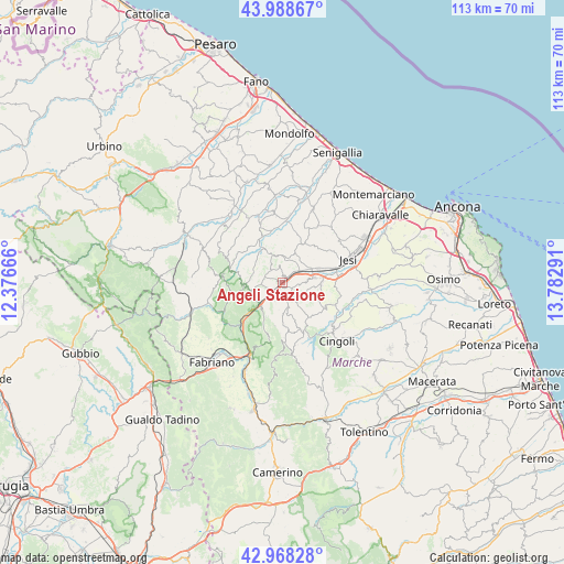
Angeli Stazione GPS coordinates[2]
43° 28' 50.268" North, 13° 4' 47.208" East
| Map corner | latitude | longitude |
|---|---|---|
| Upper-left | 43.98867°, | 12.37666° |
| Center: | 43.48063°, | 13.07978° |
| Lower-right: | 42.96828°, | 13.78291° |
| Map W x H: | 113.5×113.5 km | = 70.5×70.5mi |
| max Lat: | 47.04031° ⇑60% North |
| Angeli Stazione: | 43.48063° |
| min Lat: | ⇓40% South 35.50142° |
| min Long | Angeli Stazione | max Long |
| 6.69888° | 13.07978° | 18.48682° |
| W 69.2%⇐ | ⇒30.8% E |
Elevation
Elevation of Angeli Stazione is 134 m = 440 ft, and this is 172.7 m = 567 ft below average elevation for this country.
| Max E: |
2085 m = 6841 ft | 64% |
| Avg. | 306.7 m = 1006 ft | |
| Angeli Stazione | 134 m = 440 ft | |
Min E: |
-4 m = -13 ft | 36% |
See also: Italy elevation on elevation.city.
Geographical zone
Angeli Stazione is located in North temperate zone (between Tropic of Cancer and the Arctic Circle). Distance of this Northern Tropic circle is 2228.7 km =1384.8 mi to South.| Distance of | km | miles | from Angeli Stazione |
|---|---|---|---|
| North Pole | 5172.5 | 3214 | to North |
| Arctic Circle | 2566.6 | 1594.8 | to North |
| Tropic Cancer | 2228.7 | 1384.8 | to South |
| Equator | 4834.6 | 3004.1 | to South |


Nearby cities:
15 places around Angeli Stazione: (largest is in red/bold)
• Angeli
1.3 km =0.8 mi,  225°
225°
• Angeli di Mergo
2.7 km =1.7 mi, 228°
• Castelbellino
5.3 km =3.3 mi,  82°
82°
• Castelplanio
1.5 km =0.9 mi,  6°
6°
• Cupramontana
4.4 km =2.7 mi,  141°
141°
• Macine-Borgo Loreto
0.9 km =0.6 mi,  44°
44°
• Maiolati Spontini
3.3 km =2.1 mi,  98°
98°
• Mergo
3.7 km =2.3 mi,  257°
257°
• Moie
5 km =3.1 mi,  59°
59°
• Monte Roberto
4.7 km =2.9 mi,  90°
90°
• Montecarotto
5.4 km =3.4 mi,  348°
348°
• Poggio San Marcello
3.4 km =2.1 mi, 351°
• Rosora
1 km =0.6 mi,  287°
287°
• Serra San Quirico
6 km =3.7 mi, 230°
• Stazione
6.2 km =3.9 mi,  69°
69°
Sources, notices
• [Note1] Compared only with cities in Italy existing in our database
• [Src1] Map data: © OpenStreetMap contributors (CC-BY-SA)
• [Src2] Other city data from geonames.org with taken over terms of usage.
• [Src3] Geographical zone / Annual Mean Temperature by Robert A. Rohde @ Wikipedia
