Pianello geodata
Pianello (The Marches) is a populated place; located in Italy in Europe/Rome (GMT+2) time zone. With population of 670 people, there are 8485 cities with bigger population in this country. Compared to other cities in Italy, 59.9% of cities are located further ↑North; 70% of cities are located further ←West and 68.3% of cities have higher elevation than Pianello. Note1
Administrative division(s):
- Level 1: The Marches
- Level 2: Provincia di Ancona
- Level 3: Castelbellino


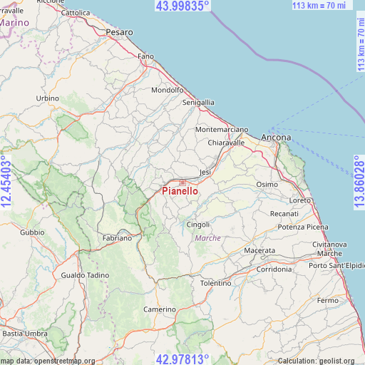
Pianello GPS coordinates[2]
43° 29' 25.404" North, 13° 9' 25.74" East
| Map corner | latitude | longitude |
|---|---|---|
| Upper-left | 43.99835°, | 12.45403° |
| Center: | 43.49039°, | 13.15715° |
| Lower-right: | 42.97813°, | 13.86028° |
| Map W x H: | 113.4×113.4 km | = 70.5×70.5mi |
| max Lat: | 47.04031° ⇑59.9% North |
| Pianello: | 43.49039° |
| min Lat: | ⇓40.1% South 35.50142° |
| min Long | Pianello | max Long |
| 6.69888° | 13.15715° | 18.48682° |
| W 70%⇐ | ⇒30% E |
Elevation
Elevation of Pianello is 107 m = 351 ft, and this is 199.7 m = 655 ft below average elevation for this country.
| Max E: |
2085 m = 6841 ft | 68.3% |
| Avg. | 306.7 m = 1006 ft | |
| Pianello | 107 m = 351 ft | |
Min E: |
-4 m = -13 ft | 31.7% |
See also: Italy elevation on elevation.city.
Geographical zone
Pianello is located in North temperate zone (between Tropic of Cancer and the Arctic Circle). Distance of this Northern Tropic circle is 2229.8 km =1385.5 mi to South.| Distance of | km | miles | from Pianello |
|---|---|---|---|
| North Pole | 5171.4 | 3213.4 | to North |
| Arctic Circle | 2565.5 | 1594.1 | to North |
| Tropic Cancer | 2229.8 | 1385.5 | to South |
| Equator | 4835.7 | 3004.8 | to South |


Nearby cities:
15 places around Pianello: (largest is in red/bold)
• Angeli Stazione
6.3 km =3.9 mi,  260°
260°
• Castelbellino
1.1 km =0.7 mi,  248°
248°
• Castelplanio
6.1 km =3.8 mi,  273°
273°
• Cupramontana
5.7 km =3.5 mi,  218°
218°
• Macine-Borgo Loreto
5.7 km =3.5 mi, 265°
• Maiolati Spontini
3.4 km =2.1 mi,  242°
242°
• Moie
2.5 km =1.6 mi,  306°
306°
• Monte Roberto
1.9 km =1.2 mi,  234°
234°
• Pianello Vallesina
0.5 km =0.3 mi,  122°
122°
• Poggio San Marcello
7.1 km =4.4 mi,  288°
288°
• Rosora
7.2 km =4.5 mi, 263°
• San Paolo di Jesi
4.2 km =2.6 mi,  162°
162°
• Scorcelletti
1.8 km =1.1 mi,  30°
30°
• Staffolo
6.7 km =4.2 mi, 160°
• Stazione
1.2 km =0.7 mi,  337°
337°
Sources, notices
• [Note1] Compared only with cities in Italy existing in our database
• [Src1] Map data: © OpenStreetMap contributors (CC-BY-SA)
• [Src2] Other city data from geonames.org with taken over terms of usage.
• [Src3] Geographical zone / Annual Mean Temperature by Robert A. Rohde @ Wikipedia
