Scorcelletti geodata
Scorcelletti (The Marches) is a populated place; located in Italy in Europe/Rome (GMT+2) time zone. With population of 610 people, there are 8915 cities with bigger population in this country. Compared to other cities in Italy, 59.8% of cities are located further ↑North; 70.1% of cities are located further ←West and 69.6% of cities have higher elevation than Scorcelletti. Note1
Administrative division(s):
- Level 1: The Marches
- Level 2: Provincia di Ancona
- Level 3: Castelbellino


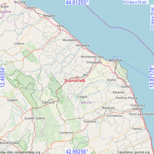
Scorcelletti GPS coordinates[2]
43° 30' 16.92" North, 13° 10' 7.176" East
| Map corner | latitude | longitude |
|---|---|---|
| Upper-left | 44.01253°, | 12.46554° |
| Center: | 43.5047°, | 13.16866° |
| Lower-right: | 42.99256°, | 13.87179° |
| Map W x H: | 113.4×113.4 km | = 70.5×70.5mi |
| max Lat: | 47.04031° ⇑59.8% North |
| Scorcelletti: | 43.5047° |
| min Lat: | ⇓40.2% South 35.50142° |
| min Long | Scorcelletti | max Long |
| 6.69888° | 13.16866° | 18.48682° |
| W 70.1%⇐ | ⇒29.9% E |
Elevation
Elevation of Scorcelletti is 100 m = 328 ft, and this is 206.7 m = 678 ft below average elevation for this country.
| Max E: |
2085 m = 6841 ft | 69.6% |
| Avg. | 306.7 m = 1006 ft | |
| Scorcelletti | 100 m = 328 ft | |
Min E: |
-4 m = -13 ft | 30.4% |
See also: Italy elevation on elevation.city.
Geographical zone
Scorcelletti is located in North temperate zone (between Tropic of Cancer and the Arctic Circle). Distance of this Northern Tropic circle is 2231.4 km =1386.5 mi to South.| Distance of | km | miles | from Scorcelletti |
|---|---|---|---|
| North Pole | 5169.8 | 3212.4 | to North |
| Arctic Circle | 2563.9 | 1593.1 | to North |
| Tropic Cancer | 2231.4 | 1386.5 | to South |
| Equator | 4837.3 | 3005.8 | to South |


Nearby cities:
15 places around Scorcelletti: (largest is in red/bold)
• Angeli Stazione
7.7 km =4.8 mi,  249°
249°
• Castelbellino
2.8 km =1.7 mi,  224°
224°
• Castelplanio
7.1 km =4.4 mi,  260°
260°
• Cupramontana
7.6 km =4.7 mi, 216°
• Jesi
6.3 km =3.9 mi,  72°
72°
• Macine-Borgo Loreto
6.9 km =4.3 mi, 252°
• Maiolati Spontini
5 km =3.1 mi,  231°
231°
• Moie
2.9 km =1.8 mi,  267°
267°
• Monte Roberto
3.7 km =2.3 mi, 222°
• Pianello
1.8 km =1.1 mi,  210°
210°
• Pianello Vallesina
1.9 km =1.2 mi,  196°
196°
• Poggio San Marcello
7.7 km =4.8 mi,  275°
275°
• San Paolo di Jesi
5.6 km =3.5 mi,  176°
176°
• Staffolo
8.1 km =5 mi,  170°
170°
• Stazione
1.5 km =0.9 mi, 251°
Sources, notices
• [Note1] Compared only with cities in Italy existing in our database
• [Src1] Map data: © OpenStreetMap contributors (CC-BY-SA)
• [Src2] Other city data from geonames.org with taken over terms of usage.
• [Src3] Geographical zone / Annual Mean Temperature by Robert A. Rohde @ Wikipedia
