Mirabello geodata
Mirabello (Emilia-Romagna) is a seat of a third-order administrative division; located in Italy in Europe/Rome (GMT+2) time zone. With population of 3,306 people, there are 2834 cities with bigger population in this country. Compared to other cities in Italy, 56.6% of cities are located further ↓South; 51.1% of cities are located further →East and 91.5% of cities have higher elevation than Mirabello. Note1
Administrative division(s):
- Level 1: Emilia-Romagna
- Level 2: Provincia di Ferrara
- Level 3: Terre del Reno


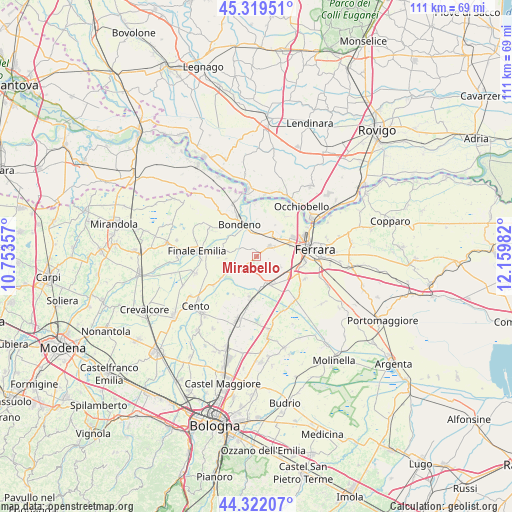
Mirabello GPS coordinates[2]
44° 49' 22.62" North, 11° 27' 24.084" East
| Map corner | latitude | longitude |
|---|---|---|
| Upper-left | 45.31951°, | 10.75357° |
| Center: | 44.82295°, | 11.45669° |
| Lower-right: | 44.32207°, | 12.15982° |
| Map W x H: | 110.9×110.9 km | = 68.9×68.9mi |
| max Lat: | 47.04031° ⇑43.4% North |
| Mirabello: | 44.82295° |
| min Lat: | ⇓56.6% South 35.50142° |
| min Long | Mirabello | max Long |
| 6.69888° | 11.45669° | 18.48682° |
| W 48.9%⇐ | ⇒51.1% E |
Elevation
Elevation of Mirabello is 15 m = 49 ft, and this is 291.7 m = 957 ft below average elevation for this country.
| Max E: |
2085 m = 6841 ft | 91.5% |
| Avg. | 306.7 m = 1006 ft | |
| Mirabello | 15 m = 49 ft | |
Min E: |
-4 m = -13 ft | 8.5% |
See also: Italy elevation on elevation.city.
Geographical zone
Mirabello is located in North temperate zone (between Tropic of Cancer and the Arctic Circle). Distance of this Northern Tropic circle is 2377.9 km =1477.6 mi to South.| Distance of | km | miles | from Mirabello |
|---|---|---|---|
| North Pole | 5023.2 | 3121.3 | to North |
| Arctic Circle | 2417.3 | 1502 | to North |
| Tropic Cancer | 2377.9 | 1477.6 | to South |
| Equator | 4983.8 | 3096.8 | to South |


Nearby cities:
15 places around Mirabello: (largest is in red/bold)
• Bondeno
8.1 km =5 mi,  336°
336°
• Casaglia
11.1 km =6.9 mi,  37°
37°
• Coronella
5.7 km =3.5 mi,  113°
113°
• Dosso
11.1 km =6.9 mi,  236°
236°
• Galliera
9.5 km =5.9 mi,  211°
211°
• Poggio Renatico
6.8 km =4.2 mi,  159°
159°
• Porotto-Cassama
7.9 km =4.9 mi,  67°
67°
• Reno Centese
10 km =6.2 mi,  273°
273°
• San Carlo
4.3 km =2.7 mi, 239°
• San Martino
11.5 km =7.1 mi,  115°
115°
• San Venanzio
8.8 km =5.5 mi,  190°
190°
• San Vincenzo
9.5 km =5.9 mi, 189°
• Sant'Agostino
6.6 km =4.1 mi, 238°
• Vigarano Mainarda
3.5 km =2.2 mi,  55°
55°
• Vigarano Pieve
6 km =3.7 mi, 44°
Sources, notices
• [Note1] Compared only with cities in Italy existing in our database
• [Src1] Map data: © OpenStreetMap contributors (CC-BY-SA)
• [Src2] Other city data from geonames.org with taken over terms of usage.
• [Src3] Geographical zone / Annual Mean Temperature by Robert A. Rohde @ Wikipedia
