Bondeno geodata
Bondeno (Emilia-Romagna) is a seat of a third-order administrative division; located in Italy in Europe/Rome (GMT+2) time zone. With population of 7,519 people, there are 1294 cities with bigger population in this country. Compared to other cities in Italy, 57.7% of cities are located further ↓South; 51.7% of cities are located further →East and 93.6% of cities have higher elevation than Bondeno. Note1


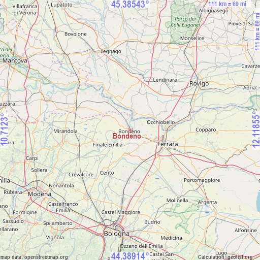
Bondeno GPS coordinates[2]
44° 53' 21.984" North, 11° 24' 55.512" East
| Map corner | latitude | longitude |
|---|---|---|
| Upper-left | 45.38543°, | 10.7123° |
| Center: | 44.88944°, | 11.41542° |
| Lower-right: | 44.38914°, | 12.11855° |
| Map W x H: | 110.8×110.8 km | = 68.8×68.8mi |
| max Lat: | 47.04031° ⇑42.3% North |
| Bondeno: | 44.88944° |
| min Lat: | ⇓57.7% South 35.50142° |
| min Long | Bondeno | max Long |
| 6.69888° | 11.41542° | 18.48682° |
| W 48.3%⇐ | ⇒51.7% E |
Elevation
Elevation of Bondeno is 11 m = 36 ft, and this is 295.7 m = 970 ft below average elevation for this country.
| Max E: |
2085 m = 6841 ft | 93.6% |
| Avg. | 306.7 m = 1006 ft | |
| Bondeno | 11 m = 36 ft | |
Min E: |
-4 m = -13 ft | 6.4% |
See also: Italy elevation on elevation.city.
Geographical zone
Bondeno is located in North temperate zone (between Tropic of Cancer and the Arctic Circle). Distance of this Northern Tropic circle is 2385.3 km =1482.2 mi to South.| Distance of | km | miles | from Bondeno |
|---|---|---|---|
| North Pole | 5015.8 | 3116.7 | to North |
| Arctic Circle | 2409.9 | 1497.4 | to North |
| Tropic Cancer | 2385.3 | 1482.2 | to South |
| Equator | 4991.2 | 3101.4 | to South |


Nearby cities:
15 places around Bondeno: (largest is in red/bold)
• Casaglia
10.1 km =6.3 mi,  81°
81°
• Felonica
11.1 km =6.9 mi,  333°
333°
• Ficarolo
7.4 km =4.6 mi,  13°
13°
• Finale Emilia
11.4 km =7.1 mi,  237°
237°
• Gaiba
8.1 km =5 mi,  39°
39°
• Mirabello
8.1 km =5 mi,  156°
156°
• Reno Centese
9.5 km =5.9 mi,  224°
224°
• Sabbioni-Zampine
10.9 km =6.8 mi,  50°
50°
• Salara
10.8 km =6.7 mi,  4°
4°
• San Carlo
9.6 km =6 mi,  182°
182°
• Sant'Agostino
11.1 km =6.9 mi,  192°
192°
• Scortichino
6.5 km =4 mi,  264°
264°
• Stienta
11.5 km =7.1 mi,  61°
61°
• Vigarano Mainarda
8.2 km =5.1 mi,  131°
131°
• Vigarano Pieve
8 km =5 mi,  112°
112°
Sources, notices
• [Note1] Compared only with cities in Italy existing in our database
• [Src1] Map data: © OpenStreetMap contributors (CC-BY-SA)
• [Src2] Other city data from geonames.org with taken over terms of usage.
• [Src3] Geographical zone / Annual Mean Temperature by Robert A. Rohde @ Wikipedia
