Vigarano Pieve geodata
Vigarano Pieve (Emilia-Romagna) is a populated place; located in Italy in Europe/Rome (GMT+2) time zone. With population of 1,988 people, there are 4181 cities with bigger population in this country. Compared to other cities in Italy, 57.3% of cities are located further ↓South; 50.5% of cities are located further →East and 92.6% of cities have higher elevation than Vigarano Pieve. Note1
Administrative division(s):
- Level 1: Emilia-Romagna
- Level 2: Provincia di Ferrara
- Level 3: Vigarano Mainarda


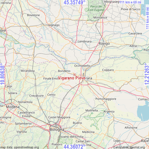
Vigarano Pieve GPS coordinates[2]
44° 51' 40.536" North, 11° 30' 34.2" East
| Map corner | latitude | longitude |
|---|---|---|
| Upper-left | 45.35749°, | 10.80638° |
| Center: | 44.86126°, | 11.5095° |
| Lower-right: | 44.36072°, | 12.21263° |
| Map W x H: | 110.8×110.8 km | = 68.8×68.8mi |
| max Lat: | 47.04031° ⇑42.7% North |
| Vigarano Pieve: | 44.86126° |
| min Lat: | ⇓57.3% South 35.50142° |
| min Long | Vigarano Pieve | max Long |
| 6.69888° | 11.5095° | 18.48682° |
| W 49.5%⇐ | ⇒50.5% E |
Elevation
Elevation of Vigarano Pieve is 13 m = 43 ft, and this is 293.7 m = 964 ft below average elevation for this country.
| Max E: |
2085 m = 6841 ft | 92.6% |
| Avg. | 306.7 m = 1006 ft | |
| Vigarano Pieve | 13 m = 43 ft | |
Min E: |
-4 m = -13 ft | 7.4% |
See also: Italy elevation on elevation.city.
Geographical zone
Vigarano Pieve is located in North temperate zone (between Tropic of Cancer and the Arctic Circle). Distance of this Northern Tropic circle is 2382.2 km =1480.2 mi to South.| Distance of | km | miles | from Vigarano Pieve |
|---|---|---|---|
| North Pole | 5019 | 3118.7 | to North |
| Arctic Circle | 2413.1 | 1499.4 | to North |
| Tropic Cancer | 2382.2 | 1480.2 | to South |
| Equator | 4988.1 | 3099.5 | to South |


Nearby cities:
15 places around Vigarano Pieve: (largest is in red/bold)
• Bondeno
8 km =5 mi,  292°
292°
• Casaglia
5.2 km =3.2 mi,  29°
29°
• Coronella
6.6 km =4.1 mi,  170°
170°
• Ferrara
9.1 km =5.7 mi,  106°
106°
• Gaiba
9.7 km =6 mi,  346°
346°
• Mirabello
6 km =3.7 mi,  224°
224°
• Occhiobello
8.8 km =5.5 mi,  39°
39°
• Poggio Renatico
10.8 km =6.7 mi,  189°
189°
• Porotto-Cassama
3.4 km =2.1 mi, 111°
• Sabbioni-Zampine
10.2 km =6.3 mi,  5°
5°
• San Carlo
10.1 km =6.3 mi,  230°
230°
• San Martino
11.1 km =6.9 mi,  146°
146°
• Santa Maria Maddalena
8.9 km =5.5 mi,  59°
59°
• Stienta
9.1 km =5.7 mi,  17°
17°
• Vigarano Mainarda
2.6 km =1.6 mi,  208°
208°
Sources, notices
• [Note1] Compared only with cities in Italy existing in our database
• [Src1] Map data: © OpenStreetMap contributors (CC-BY-SA)
• [Src2] Other city data from geonames.org with taken over terms of usage.
• [Src3] Geographical zone / Annual Mean Temperature by Robert A. Rohde @ Wikipedia
