Lunano geodata
Lunano (The Marches) is a seat of a third-order administrative division; located in Italy in Europe/Rome (GMT+1) time zone. With population of 1,288 people, there are 5671 cities with bigger population in this country. Compared to other cities in Italy, 57.7% of cities are located further ↑North; 61.8% of cities are located further ←West and 56.6% of cities have lower elevation than Lunano. Note1
Administrative division(s):
- Level 1: The Marches
- Level 2: Provincia di Pesaro e Urbino
- Level 3: Lunano


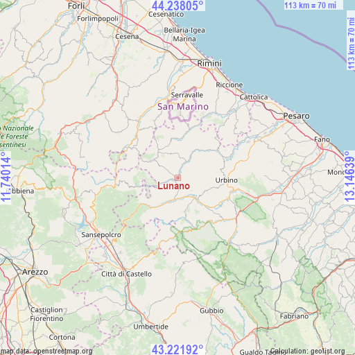
Lunano GPS coordinates[2]
43° 43' 55.704" North, 12° 26' 35.736" East
| Map corner | latitude | longitude |
|---|---|---|
| Upper-left | 44.23805°, | 11.74014° |
| Center: | 43.73214°, | 12.44326° |
| Lower-right: | 43.22192°, | 13.14639° |
| Map W x H: | 113×113 km | = 70.2×70.2mi |
| max Lat: | 47.04031° ⇑57.7% North |
| Lunano: | 43.73214° |
| min Lat: | ⇓42.3% South 35.50142° |
| min Long | Lunano | max Long |
| 6.69888° | 12.44326° | 18.48682° |
| W 61.8%⇐ | ⇒38.2% E |
Elevation
Elevation of Lunano is 276 m = 906 ft, and this is 30.7 m = 101 ft below average elevation for this country.
| Max E: |
2085 m = 6841 ft | 43.4% |
| Avg. | 306.7 m = 1006 ft | |
| Lunano | 276 m = 906 ft | |
Min E: |
-4 m = -13 ft | 56.6% |
See also: Italy elevation on elevation.city.
Geographical zone
Lunano is located in North temperate zone (between Tropic of Cancer and the Arctic Circle). Distance of this Northern Tropic circle is 2256.6 km =1402.2 mi to South.| Distance of | km | miles | from Lunano |
|---|---|---|---|
| North Pole | 5144.5 | 3196.6 | to North |
| Arctic Circle | 2538.6 | 1577.4 | to North |
| Tropic Cancer | 2256.6 | 1402.2 | to South |
| Equator | 4862.6 | 3021.5 | to South |


Nearby cities:
15 places around Lunano: (largest is in red/bold)
• Belforte
5.7 km =3.5 mi,  252°
252°
• Carpegna
10.2 km =6.3 mi,  302°
302°
• Frontino
6.4 km =4 mi, 304°
• Macerata Feltria
7.9 km =4.9 mi,  359°
359°
• Mercatale
6.5 km =4 mi,  30°
30°
• Mercatello sul Metauro
12.8 km =8 mi,  222°
222°
• Mercato Vecchio
9.6 km =6 mi,  326°
326°
• Monte Cerignone
12.2 km =7.6 mi,  349°
349°
• Peglio
5.9 km =3.7 mi,  132°
132°
• Piandimeleto
3 km =1.9 mi, 250°
• Sant'Angelo in Vado
7.7 km =4.8 mi,  195°
195°
• Sassocorvaro
7.2 km =4.5 mi,  38°
38°
• Sestino
11.9 km =7.4 mi,  257°
257°
• Urbania
9.5 km =5.9 mi,  138°
138°
• Villagrande
13.9 km =8.6 mi, 331°
Sources, notices
• [Note1] Compared only with cities in Italy existing in our database
• [Src1] Map data: © OpenStreetMap contributors (CC-BY-SA)
• [Src2] Other city data from geonames.org with taken over terms of usage.
• [Src3] Geographical zone / Annual Mean Temperature by Robert A. Rohde @ Wikipedia
