Carpegna geodata
Carpegna (The Marches) is a seat of a third-order administrative division; located in Italy in Europe/Rome (GMT+2) time zone. With population of 1,445 people, there are 5260 cities with bigger population in this country. Compared to other cities in Italy, 57.2% of cities are located further ↑North; 60.4% of cities are located further ←West and 91.1% of cities have lower elevation than Carpegna. Note1
Administrative division(s):
- Level 1: The Marches
- Level 2: Provincia di Pesaro e Urbino
- Level 3: Carpegna


Carpegna GPS coordinates[2]
43° 46' 51.96" North, 12° 20' 7.548" East
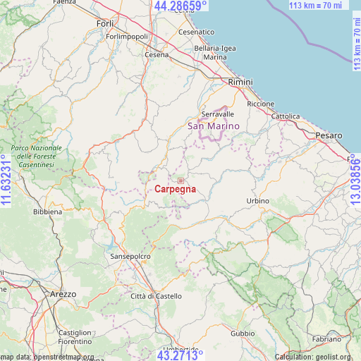
| Map corner | latitude | longitude |
|---|---|---|
| Upper-left | 44.28659°, | 11.63231° |
| Center: | 43.7811°, | 12.33543° |
| Lower-right: | 43.2713°, | 13.03856° |
| Map W x H: | 112.9×112.9 km | = 70.2×70.2mi |
| max Lat: | 47.04031° ⇑57.2% North |
| Carpegna: | 43.7811° |
| min Lat: | ⇓42.8% South 35.50142° |
| min Long | Carpegna | max Long |
| 6.69888° | 12.33543° | 18.48682° |
| W 60.4%⇐ | ⇒39.6% E |
Elevation
Elevation of Carpegna is 747 m = 2451 ft, and this is 440.3 m = 1445 ft above average elevation for this country.
| Max E: |
2085 m = 6841 ft | 8.9% |
| Carpegna | 747 m 2451 ft | |
| Avg. | 306.7 m = 1006 ft | |
Min E: |
-4 m = -13 ft | 91.1% |
See also: Italy elevation on elevation.city.
Geographical zone
Carpegna is located in North temperate zone (between Tropic of Cancer and the Arctic Circle). Distance of this Northern Tropic circle is 2262.1 km =1405.6 mi to South.| Distance of | km | miles | from Carpegna |
|---|---|---|---|
| North Pole | 5139.1 | 3193.3 | to North |
| Arctic Circle | 2533.2 | 1574.1 | to North |
| Tropic Cancer | 2262.1 | 1405.6 | to South |
| Equator | 4868 | 3024.8 | to South |


Nearby cities:
15 places around Carpegna: (largest is in red/bold)
• Belforte
7.9 km =4.9 mi,  155°
155°
• Frontino
3.8 km =2.4 mi,  119°
119°
• Lunano
10.2 km =6.3 mi, 122°
• Macerata Feltria
8.9 km =5.5 mi,  74°
74°
• Mercatale
12 km =7.5 mi,  89°
89°
• Mercato Vecchio
4.2 km =2.6 mi,  52°
52°
• Monte Cerignone
9.1 km =5.7 mi,  44°
44°
• Novafeltria
13.2 km =8.2 mi,  343°
343°
• Pennabilli
6.8 km =4.2 mi,  306°
306°
• Piandimeleto
8.7 km =5.4 mi,  137°
137°
• San Leo
12.8 km =8 mi,  3°
3°
• Sassocorvaro
13.1 km =8.1 mi, 89°
• Serra di Maiolo
10.4 km =6.5 mi,  349°
349°
• Sestino
8.5 km =5.3 mi,  200°
200°
• Villagrande
7 km =4.3 mi,  16°
16°
Sources, notices
• [Note1] Compared only with cities in Italy existing in our database
• [Src1] Map data: © OpenStreetMap contributors (CC-BY-SA)
• [Src2] Other city data from geonames.org with taken over terms of usage.
• [Src3] Geographical zone / Annual Mean Temperature by Robert A. Rohde @ Wikipedia
