Lignano Sabbiadoro geodata
Lignano Sabbiadoro (Friuli Venezia Giulia) is a seat of a third-order administrative division; located in Italy in Europe/Rome (GMT+2) time zone. With population of 5,837 people, there are 1682 cities with bigger population in this country. Compared to other cities in Italy, 80.1% of cities are located further ↓South; 69.6% of cities are located further ←West and 96.6% of cities have higher elevation than Lignano Sabbiadoro. Note1
Administrative division(s):
- Level 1: Friuli Venezia Giulia
- Level 2: Provincia di Udine
- Level 3: Lignano Sabbiadoro


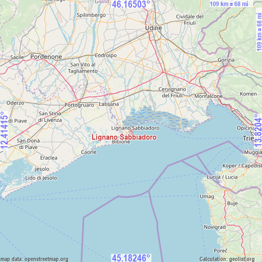
Lignano Sabbiadoro GPS coordinates[2]
45° 40' 33.24" North, 13° 7' 2.172" East
| Map corner | latitude | longitude |
|---|---|---|
| Upper-left | 46.16503°, | 12.41415° |
| Center: | 45.6759°, | 13.11727° |
| Lower-right: | 45.18246°, | 13.8204° |
| Map W x H: | 109.3×109.3 km | = 67.9×67.9mi |
| max Lat: | 47.04031° ⇑19.9% North |
| Lignano Sabbiadoro: | 45.6759° |
| min Lat: | ⇓80.1% South 35.50142° |
| min Long | Lignano Sabbiad | max Long |
| 6.69888° | 13.11727° | 18.48682° |
| W 69.6%⇐ | ⇒30.4% E |
Elevation
Elevation of Lignano Sabbiadoro is 6 m = 20 ft, and this is 300.7 m = 987 ft below average elevation for this country.
| Max E: |
2085 m = 6841 ft | 96.6% |
| Avg. | 306.7 m = 1006 ft | |
| Lignano Sabbiadoro | 6 m = 20 ft | |
Min E: |
-4 m = -13 ft | 3.4% |
See also: Italy elevation on elevation.city.
Geographical zone
Lignano Sabbiadoro is located in North temperate zone (between Tropic of Cancer and the Arctic Circle). Distance of this North polar circle is 2322.5 km =1443.1 mi to North.| Distance of | km | miles | from Lignano Sabbiadoro |
|---|---|---|---|
| North Pole | 4928.4 | 3062.4 | to North |
| Arctic Circle | 2322.5 | 1443.1 | to North |
| Tropic Cancer | 2472.8 | 1536.5 | to South |
| Equator | 5078.7 | 3155.8 | to South |


Nearby cities:
15 places around Lignano Sabbiadoro: (largest is in red/bold)
• Bibione
7.7 km =4.8 mi,  234°
234°
• Carlino
15.2 km =9.4 mi,  21°
21°
• Casale della Madonna
11.9 km =7.4 mi, 19°
• Cesarolo
9.2 km =5.7 mi,  301°
301°
• Gorgo
10.7 km =6.6 mi,  317°
317°
• Latisana
13.4 km =8.3 mi, 320°
• Lugugnana
13.8 km =8.6 mi, 297°
• Marano Lagunare
10.5 km =6.5 mi, 21°
• Muzzana del Turgnano
15.8 km =9.8 mi,  2°
2°
• Palazzolo dello Stella
13.8 km =8.6 mi,  350°
350°
• Pertegada
7.7 km =4.8 mi,  311°
311°
• Precenicco
13.8 km =8.6 mi, 346°
• Rivarotta
16.4 km =10.2 mi, 350°
• Ronchis
17.5 km =10.9 mi,  327°
327°
• San Michele al Tagliamento
13.7 km =8.5 mi, 316°
Sources, notices
• [Note1] Compared only with cities in Italy existing in our database
• [Src1] Map data: © OpenStreetMap contributors (CC-BY-SA)
• [Src2] Other city data from geonames.org with taken over terms of usage.
• [Src3] Geographical zone / Annual Mean Temperature by Robert A. Rohde @ Wikipedia
