Latisana geodata
Latisana (Friuli Venezia Giulia) is a seat of a third-order administrative division; located in Italy in Europe/Rome (GMT+2) time zone. With population of 8,896 people, there are 1070 cities with bigger population in this country. Compared to other cities in Italy, 84.4% of cities are located further ↓South; 68.3% of cities are located further ←West and 98.4% of cities have higher elevation than Latisana. Note1
Administrative division(s):
- Level 1: Friuli Venezia Giulia
- Level 2: Provincia di Udine
- Level 3: Latisana


Latisana GPS coordinates[2]
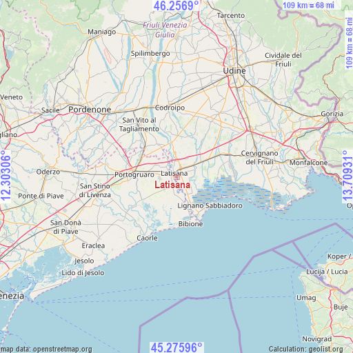
45° 46' 6.924" North, 13° 0' 22.248" East
| Map corner | latitude | longitude |
|---|---|---|
| Upper-left | 46.2569°, | 12.30306° |
| Center: | 45.76859°, | 13.00618° |
| Lower-right: | 45.27596°, | 13.70931° |
| Map W x H: | 109.1×109.1 km | = 67.8×67.8mi |
| max Lat: | 47.04031° ⇑15.6% North |
| Latisana: | 45.76859° |
| min Lat: | ⇓84.4% South 35.50142° |
| min Long | Latisana | max Long |
| 6.69888° | 13.00618° | 18.48682° |
| W 68.3%⇐ | ⇒31.7% E |
Elevation
Elevation of Latisana is 3 m = 10 ft, and this is 303.7 m = 996 ft below average elevation for this country.
| Max E: |
2085 m = 6841 ft | 98.4% |
| Avg. | 306.7 m = 1006 ft | |
| Latisana | 3 m = 10 ft | |
Min E: |
-4 m = -13 ft | 1.6% |
See also: Italy elevation on elevation.city.
Geographical zone
Latisana is located in North temperate zone (between Tropic of Cancer and the Arctic Circle). Distance of this North polar circle is 2312.2 km =1436.7 mi to North.| Distance of | km | miles | from Latisana |
|---|---|---|---|
| North Pole | 4918.1 | 3056 | to North |
| Arctic Circle | 2312.2 | 1436.7 | to North |
| Tropic Cancer | 2483.1 | 1542.9 | to South |
| Equator | 5089 | 3162.2 | to South |


Nearby cities:
15 places around Latisana: (largest is in red/bold)
• Cesarolo
5.6 km =3.5 mi,  172°
172°
• Fossalta di Portogruaro
7.9 km =4.9 mi,  290°
290°
• Gorgo
2.8 km =1.7 mi,  150°
150°
• Lugugnana
5.4 km =3.4 mi,  222°
222°
• Palazzolo dello Stella
7.1 km =4.4 mi,  62°
62°
• Pertegada
6 km =3.7 mi, 150°
• Pocenia
10.5 km =6.5 mi,  44°
44°
• Precenicco
6.2 km =3.9 mi, 59°
• Rivarotta
8.3 km =5.2 mi, 44°
• Ronchis
4.5 km =2.8 mi,  349°
349°
• San Giorgio al Tagliamento-Pozzi
4.5 km =2.8 mi,  313°
313°
• San Michele al Tagliamento
1 km =0.6 mi,  241°
241°
• Stiago
9.1 km =5.7 mi,  275°
275°
• Teor
10.3 km =6.4 mi,  22°
22°
• Villanova Santa Margherita
8.6 km =5.3 mi,  268°
268°
Sources, notices
• [Note1] Compared only with cities in Italy existing in our database
• [Src1] Map data: © OpenStreetMap contributors (CC-BY-SA)
• [Src2] Other city data from geonames.org with taken over terms of usage.
• [Src3] Geographical zone / Annual Mean Temperature by Robert A. Rohde @ Wikipedia
