Tellaro geodata
Tellaro (Liguria) is a populated locality; located in Italy in Europe/Rome (GMT+2) time zone. With population of 559 people, there are 9357 cities with bigger population in this country. Compared to other cities in Italy, 54.1% of cities are located further ↑North; 68.5% of cities are located further →East and 84.1% of cities have higher elevation than Tellaro. Note1


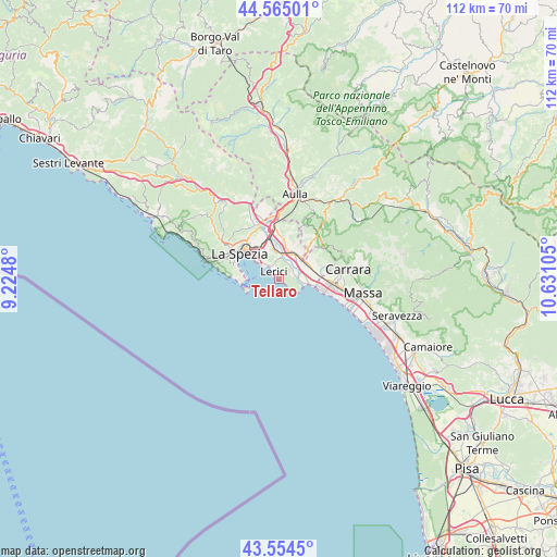
Tellaro GPS coordinates[2]
44° 3' 42.876" North, 9° 55' 40.512" East
| Map corner | latitude | longitude |
|---|---|---|
| Upper-left | 44.56501°, | 9.2248° |
| Center: | 44.06191°, | 9.92792° |
| Lower-right: | 43.5545°, | 10.63105° |
| Map W x H: | 112.4×112.4 km | = 69.8×69.8mi |
| max Lat: | 47.04031° ⇑54.1% North |
| Tellaro: | 44.06191° |
| min Lat: | ⇓45.9% South 35.50142° |
| min Long | Tellaro | max Long |
| 6.69888° | 9.92792° | 18.48682° |
| W 31.5%⇐ | ⇒68.5% E |
Elevation
Elevation of Tellaro is 34 m = 112 ft, and this is 272.7 m = 895 ft below average elevation for this country.
| Max E: |
2085 m = 6841 ft | 84.1% |
| Avg. | 306.7 m = 1006 ft | |
| Tellaro | 34 m = 112 ft | |
Min E: |
-4 m = -13 ft | 15.9% |
See also: Italy elevation on elevation.city.
Geographical zone
Tellaro is located in North temperate zone (between Tropic of Cancer and the Arctic Circle). Distance of this Northern Tropic circle is 2293.3 km =1425 mi to South.| Distance of | km | miles | from Tellaro |
|---|---|---|---|
| North Pole | 5107.8 | 3173.8 | to North |
| Arctic Circle | 2501.9 | 1554.6 | to North |
| Tropic Cancer | 2293.3 | 1425 | to South |
| Equator | 4899.2 | 3044.2 | to South |


Nearby cities:
15 places around Tellaro: (largest is in red/bold)
• Ameglia
3.2 km =2 mi,  71°
71°
• Arcola
6.3 km =3.9 mi,  348°
348°
• Borghetto-Melara
6.5 km =4 mi,  50°
50°
• Castelnuovo Magra
8.3 km =5.2 mi,  59°
59°
• Colombiera-Molicciara
7.2 km =4.5 mi, 66°
• Fiumaretta di Ameglia
5 km =3.1 mi,  101°
101°
• Le Grazie
7.5 km =4.7 mi,  274°
274°
• Lerici
2 km =1.2 mi,  319°
319°
• Luni Mare
6 km =3.7 mi,  92°
92°
• Pitelli
5 km =3.1 mi, 316°
• Portovenere
7.6 km =4.7 mi,  260°
260°
• Romito Magra
4.1 km =2.5 mi,  4°
4°
• San Terenzo
3.6 km =2.2 mi, 316°
• Sarzana
6.2 km =3.9 mi,  26°
26°
• Stazione-Fornola
8.1 km =5 mi,  338°
338°
Sources, notices
• [Note1] Compared only with cities in Italy existing in our database
• [Src1] Map data: © OpenStreetMap contributors (CC-BY-SA)
• [Src2] Other city data from geonames.org with taken over terms of usage.
• [Src3] Geographical zone / Annual Mean Temperature by Robert A. Rohde @ Wikipedia
