Lavenone geodata
Lavenone (Lombardy) is a seat of a third-order administrative division; located in Italy in Europe/Rome (GMT+2) time zone. With population of 506 people, there are 9871 cities with bigger population in this country. Compared to other cities in Italy, 83% of cities are located further ↓South; 63.5% of cities are located further →East and 67.4% of cities have lower elevation than Lavenone. Note1


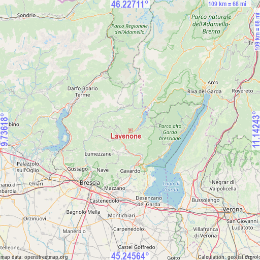
Lavenone GPS coordinates[2]
45° 44' 18.708" North, 10° 26' 21.48" East
| Map corner | latitude | longitude |
|---|---|---|
| Upper-left | 46.22711°, | 9.73618° |
| Center: | 45.73853°, | 10.4393° |
| Lower-right: | 45.24564°, | 11.14243° |
| Map W x H: | 109.1×109.1 km | = 67.8×67.8mi |
| max Lat: | 47.04031° ⇑17% North |
| Lavenone: | 45.73853° |
| min Lat: | ⇓83% South 35.50142° |
| min Long | Lavenone | max Long |
| 6.69888° | 10.4393° | 18.48682° |
| W 36.5%⇐ | ⇒63.5% E |
Elevation
Elevation of Lavenone is 367 m = 1204 ft, and this is 60.3 m = 198 ft above average elevation for this country.
| Max E: |
2085 m = 6841 ft | 32.6% |
| Lavenone | 367 m 1204 ft | |
| Avg. | 306.7 m = 1006 ft | |
Min E: |
-4 m = -13 ft | 67.4% |
See also: Italy elevation on elevation.city.
Geographical zone
Lavenone is located in North temperate zone (between Tropic of Cancer and the Arctic Circle). Distance of this North polar circle is 2315.5 km =1438.8 mi to North.| Distance of | km | miles | from Lavenone |
|---|---|---|---|
| North Pole | 4921.4 | 3058 | to North |
| Arctic Circle | 2315.5 | 1438.8 | to North |
| Tropic Cancer | 2479.7 | 1540.8 | to South |
| Equator | 5085.6 | 3160 | to South |


Nearby cities:
15 places around Lavenone: (largest is in red/bold)
• Anfo
5.2 km =3.2 mi,  54°
54°
• Barghe
7.1 km =4.4 mi,  200°
200°
• Capovalle
8.3 km =5.2 mi,  78°
78°
• Cedessano
5.6 km =3.5 mi,  184°
184°
• Crone
2.8 km =1.7 mi,  92°
92°
• Idro
2.7 km =1.7 mi,  95°
95°
• Mura
8.1 km =5 mi,  249°
249°
• Pertica Alta
7.4 km =4.6 mi,  273°
273°
• Pertica Bassa
5.4 km =3.4 mi,  287°
287°
• Preseglie
8.5 km =5.3 mi, 202°
• Provaglio Val Sabbia
5.5 km =3.4 mi, 184°
• Sabbio Chiese
9.3 km =5.8 mi,  188°
188°
• Sottocastello
8.7 km =5.4 mi, 203°
• Trebbio
3.3 km =2.1 mi,  148°
148°
• Vestone
4.8 km =3 mi,  224°
224°
Sources, notices
• [Note1] Compared only with cities in Italy existing in our database
• [Src1] Map data: © OpenStreetMap contributors (CC-BY-SA)
• [Src2] Other city data from geonames.org with taken over terms of usage.
• [Src3] Geographical zone / Annual Mean Temperature by Robert A. Rohde @ Wikipedia
