San Giovanni-San Bernardino geodata
San Giovanni-San Bernardino (Emilia-Romagna) is a seat of a third-order administrative division; located in Italy in Europe/Rome (GMT+2) time zone. With population of 1,788 people, there are 4506 cities with bigger population in this country. Compared to other cities in Italy, 56.1% of cities are located further ↓South; 71.9% of cities are located further →East and 63.3% of cities have lower elevation than San Giovanni-San Bernardino. Note1
Current local time in San Giovanni-San Bernardino:
09:33 PM, WednesdayDifference from your time zone: hours


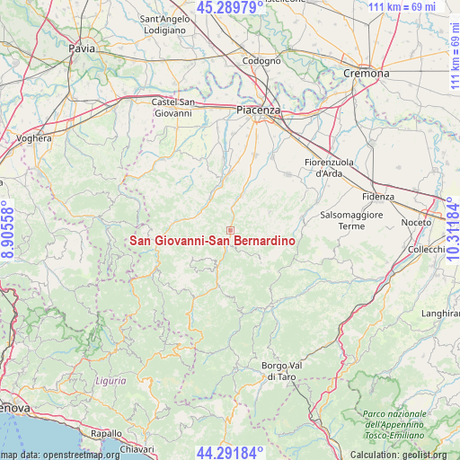
San Giovanni-San Bernardino GPS coordinates[2]
44° 47' 34.692" North, 9° 36' 31.356" East
| Map corner | latitude | longitude |
|---|---|---|
| Upper-left | 45.28979°, | 8.90558° |
| Center: | 44.79297°, | 9.60871° |
| Lower-right: | 44.29184°, | 10.31184° |
| Map W x H: | 111×111 km | = 69×69mi |
| max Lat: | 47.04031° ⇑43.9% North |
| San Giovanni-San Bernardino: | 44.79297° |
| min Lat: | ⇓56.1% South 35.50142° |
| min Long | San Giovanni-Sa | max Long |
| 6.69888° | 9.60871° | 18.48682° |
| W 28.1%⇐ | ⇒71.9% E |
Elevation
Elevation of San Giovanni-San Bernardino is 327 m = 1073 ft, and this is 20.3 m = 67 ft above average elevation for this country.
| Max E: |
2085 m = 6841 ft | 36.7% |
| San Giovanni-San Bernardino | 327 m 1073 ft | |
| Avg. | 306.7 m = 1006 ft | |
Min E: |
-4 m = -13 ft | 63.3% |
See also: Italy elevation on elevation.city.
Geographical zone
San Giovanni-San Bernardino is located in North temperate zone (between Tropic of Cancer and the Arctic Circle). Distance of this Northern Tropic circle is 2374.6 km =1475.5 mi to South.| Distance of | km | miles | from San Giovanni-San Bernardino |
|---|---|---|---|
| North Pole | 5026.6 | 3123.4 | to North |
| Arctic Circle | 2420.7 | 1504.2 | to North |
| Tropic Cancer | 2374.6 | 1475.5 | to South |
| Equator | 4980.5 | 3094.7 | to South |


Nearby cities:
15 places around San Giovanni-San Bernardino: (largest is in red/bold)
• Bettola
1.6 km =1 mi,  180°
180°
• Bobbio
17.9 km =11.1 mi,  261°
261°
• Bore
16.7 km =10.4 mi,  119°
119°
• Coli
16.2 km =10.1 mi,  251°
251°
• Farini
9.5 km =5.9 mi,  199°
199°
• Gropparello
10.4 km =6.5 mi,  64°
64°
• Lugagnano Val d'Arda
17.6 km =10.9 mi,  79°
79°
• Morfasso
10.7 km =6.6 mi,  136°
136°
• Niviano
16.5 km =10.3 mi,  5°
5°
• Piozzano
17.2 km =10.7 mi,  328°
328°
• Ponte dell'Olio
8.8 km =5.5 mi,  18°
18°
• Rivergaro
13.6 km =8.5 mi,  358°
358°
• Travo
9.3 km =5.8 mi, 326°
• Vernasca
17.5 km =10.9 mi,  87°
87°
• Vigolzone
14.3 km =8.9 mi, 19°
Sources, notices
• [Note1] Compared only with cities in Italy existing in our database
• [Src1] Map data: © OpenStreetMap contributors (CC-BY-SA)
• [Src2] Other city data from geonames.org with taken over terms of usage.
• [Src3] Geographical zone / Annual Mean Temperature by Robert A. Rohde @ Wikipedia
