Genga geodata
Genga (The Marches) is a seat of a third-order administrative division; located in Italy in Europe/Rome (GMT+2) time zone. With population of 108 people, there are 11412 cities with bigger population in this country. Compared to other cities in Italy, 60.4% of cities are located further ↑North; 67.5% of cities are located further ←West and 60.5% of cities have lower elevation than Genga. Note1


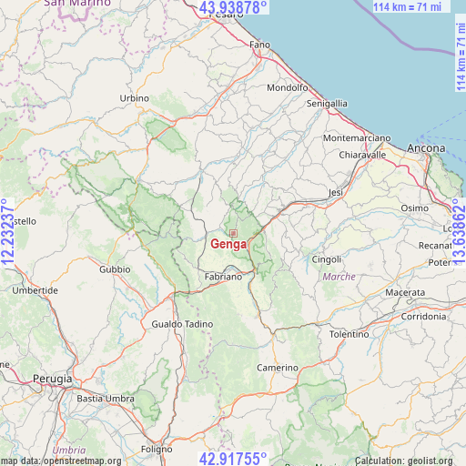
Genga GPS coordinates[2]
43° 25' 49.152" North, 12° 56' 7.764" East
| Map corner | latitude | longitude |
|---|---|---|
| Upper-left | 43.93878°, | 12.23237° |
| Center: | 43.43032°, | 12.93549° |
| Lower-right: | 42.91755°, | 13.63862° |
| Map W x H: | 113.6×113.5 km | = 70.6×70.5mi |
| max Lat: | 47.04031° ⇑60.4% North |
| Genga: | 43.43032° |
| min Lat: | ⇓39.6% South 35.50142° |
| min Long | Genga | max Long |
| 6.69888° | 12.93549° | 18.48682° |
| W 67.5%⇐ | ⇒32.5% E |
Elevation
Elevation of Genga is 303 m = 994 ft, and this is 3.7 m = 12 ft below average elevation for this country.
| Max E: |
2085 m = 6841 ft | 39.5% |
| Avg. | 306.7 m = 1006 ft | |
| Genga | 303 m = 994 ft | |
Min E: |
-4 m = -13 ft | 60.5% |
See also: Italy elevation on elevation.city.
Geographical zone
Genga is located in North temperate zone (between Tropic of Cancer and the Arctic Circle). Distance of this Northern Tropic circle is 2223.1 km =1381.4 mi to South.| Distance of | km | miles | from Genga |
|---|---|---|---|
| North Pole | 5178.1 | 3217.5 | to North |
| Arctic Circle | 2572.2 | 1598.3 | to North |
| Tropic Cancer | 2223.1 | 1381.4 | to South |
| Equator | 4829 | 3000.6 | to South |


Nearby cities:
15 places around Genga: (largest is in red/bold)
• Angeli
11.7 km =7.3 mi,  66°
66°
• Angeli Stazione
12.9 km =8 mi,  64°
64°
• Angeli di Mergo
10.4 km =6.5 mi, 68°
• Arcevia
8 km =5 mi,  5°
5°
• Castelplanio
13.8 km =8.6 mi, 58°
• Cerreto d'Esi
13.3 km =8.3 mi,  161°
161°
• Fabriano
10.4 km =6.5 mi,  194°
194°
• Macine-Borgo Loreto
13.7 km =8.5 mi, 63°
• Marischio
11.4 km =7.1 mi,  207°
207°
• Mergo
9.4 km =5.8 mi, 59°
• Piano di Frassineta
7.5 km =4.7 mi,  287°
287°
• Poggio San Vicino
13.2 km =8.2 mi,  117°
117°
• Rosora
12.2 km =7.6 mi, 61°
• Sassoferrato
6.4 km =4 mi,  270°
270°
• Serra San Quirico
7.3 km =4.5 mi,  75°
75°
Sources, notices
• [Note1] Compared only with cities in Italy existing in our database
• [Src1] Map data: © OpenStreetMap contributors (CC-BY-SA)
• [Src2] Other city data from geonames.org with taken over terms of usage.
• [Src3] Geographical zone / Annual Mean Temperature by Robert A. Rohde @ Wikipedia
