Marischio geodata
Marischio (The Marches) is a populated place; located in Italy in Europe/Rome (GMT+2) time zone. With population of 577 people, there are 9203 cities with bigger population in this country. Compared to other cities in Italy, 60.9% of cities are located further ↑North; 66.8% of cities are located further ←West and 68.9% of cities have lower elevation than Marischio. Note1


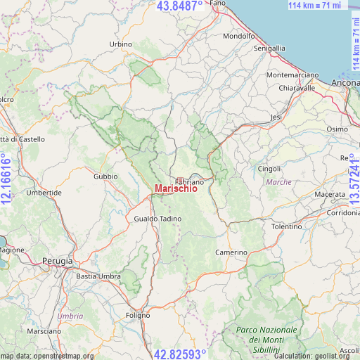
Marischio GPS coordinates[2]
43° 20' 22.092" North, 12° 52' 9.408" East
| Map corner | latitude | longitude |
|---|---|---|
| Upper-left | 43.8487°, | 12.16616° |
| Center: | 43.33947°, | 12.86928° |
| Lower-right: | 42.82593°, | 13.57241° |
| Map W x H: | 113.7×113.7 km | = 70.6×70.6mi |
| max Lat: | 47.04031° ⇑60.9% North |
| Marischio: | 43.33947° |
| min Lat: | ⇓39.1% South 35.50142° |
| min Long | Marischio | max Long |
| 6.69888° | 12.86928° | 18.48682° |
| W 66.8%⇐ | ⇒33.2% E |
Elevation
Elevation of Marischio is 383 m = 1257 ft, and this is 76.3 m = 250 ft above average elevation for this country.
| Max E: |
2085 m = 6841 ft | 31.1% |
| Marischio | 383 m 1257 ft | |
| Avg. | 306.7 m = 1006 ft | |
Min E: |
-4 m = -13 ft | 68.9% |
See also: Italy elevation on elevation.city.
Geographical zone
Marischio is located in North temperate zone (between Tropic of Cancer and the Arctic Circle). Distance of this Northern Tropic circle is 2213 km =1375.1 mi to South.| Distance of | km | miles | from Marischio |
|---|---|---|---|
| North Pole | 5188.2 | 3223.8 | to North |
| Arctic Circle | 2582.3 | 1604.6 | to North |
| Tropic Cancer | 2213 | 1375.1 | to South |
| Equator | 4818.9 | 2994.3 | to South |


Nearby cities:
15 places around Marischio: (largest is in red/bold)
• Cerqueto
15.4 km =9.6 mi,  219°
219°
• Cerreto d'Esi
9.9 km =6.2 mi,  104°
104°
• Costacciaro
12.8 km =8 mi,  279°
279°
• Esanatoglia
11.6 km =7.2 mi,  146°
146°
• Fabriano
2.7 km =1.7 mi,  90°
90°
• Fossato di Vico
10 km =6.2 mi,  241°
241°
• Genga
11.4 km =7.1 mi,  27°
27°
• Gualdo Tadino
14.3 km =8.9 mi,  210°
210°
• Matelica
14.4 km =8.9 mi,  129°
129°
• Osteria del Gatto
11.7 km =7.3 mi, 238°
• Palazzo Mancinelli-Vaccara
12.4 km =7.7 mi, 223°
• Piano di Frassineta
12.5 km =7.8 mi,  351°
351°
• Purello
9.4 km =5.8 mi,  254°
254°
• Sassoferrato
10.2 km =6.3 mi, 354°
• Sigillo
10.4 km =6.5 mi,  264°
264°
Sources, notices
• [Note1] Compared only with cities in Italy existing in our database
• [Src1] Map data: © OpenStreetMap contributors (CC-BY-SA)
• [Src2] Other city data from geonames.org with taken over terms of usage.
• [Src3] Geographical zone / Annual Mean Temperature by Robert A. Rohde @ Wikipedia
