Fontignano geodata
Fontignano (Umbria) is a populated place; located in Italy in Europe/Rome (GMT+2) time zone. With population of 1,029 people, there are 6545 cities with bigger population in this country. Compared to other cities in Italy, 63.2% of cities are located further ↑North; 58.5% of cities are located further ←West and 56.8% of cities have lower elevation than Fontignano. Note1


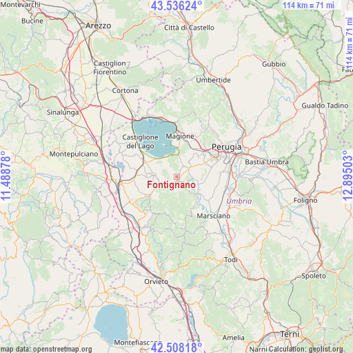
Fontignano GPS coordinates[2]
43° 1' 27.696" North, 12° 11' 30.84" East
| Map corner | latitude | longitude |
|---|---|---|
| Upper-left | 43.53624°, | 11.48878° |
| Center: | 43.02436°, | 12.1919° |
| Lower-right: | 42.50818°, | 12.89503° |
| Map W x H: | 114.3×114.3 km | = 71×71mi |
| max Lat: | 47.04031° ⇑63.2% North |
| Fontignano: | 43.02436° |
| min Lat: | ⇓36.8% South 35.50142° |
| min Long | Fontignano | max Long |
| 6.69888° | 12.1919° | 18.48682° |
| W 58.5%⇐ | ⇒41.5% E |
Elevation
Elevation of Fontignano is 277 m = 909 ft, and this is 29.7 m = 97 ft below average elevation for this country.
| Max E: |
2085 m = 6841 ft | 43.2% |
| Avg. | 306.7 m = 1006 ft | |
| Fontignano | 277 m = 909 ft | |
Min E: |
-4 m = -13 ft | 56.8% |
See also: Italy elevation on elevation.city.
Geographical zone
Fontignano is located in North temperate zone (between Tropic of Cancer and the Arctic Circle). Distance of this Northern Tropic circle is 2177.9 km =1353.3 mi to South.| Distance of | km | miles | from Fontignano |
|---|---|---|---|
| North Pole | 5223.2 | 3245.5 | to North |
| Arctic Circle | 2617.3 | 1626.3 | to North |
| Tropic Cancer | 2177.9 | 1353.3 | to South |
| Equator | 4783.9 | 2972.6 | to South |


Nearby cities:
15 places around Fontignano: (largest is in red/bold)
• Agello
6.4 km =4 mi,  36°
36°
• Castiglione della Valle
4.9 km =3 mi,  95°
95°
• Macchie
10.5 km =6.5 mi,  292°
292°
• Mugnano
4.1 km =2.5 mi,  33°
33°
• Paciano
10.1 km =6.3 mi,  269°
269°
• Panicale
7.5 km =4.7 mi, 273°
• Panicarola
10 km =6.2 mi,  300°
300°
• Piegaro
10.9 km =6.8 mi,  233°
233°
• Pietrafitta
4.1 km =2.5 mi,  155°
155°
• San Biagio della Valle
7.8 km =4.8 mi,  93°
93°
• San Feliciano
10.6 km =6.6 mi,  348°
348°
• San Savino
9.3 km =5.8 mi,  0°
0°
• Sant'Arcangelo
7.2 km =4.5 mi,  338°
338°
• Spina
8.5 km =5.3 mi,  120°
120°
• Tavernelle
4.5 km =2.8 mi,  238°
238°
Sources, notices
• [Note1] Compared only with cities in Italy existing in our database
• [Src1] Map data: © OpenStreetMap contributors (CC-BY-SA)
• [Src2] Other city data from geonames.org with taken over terms of usage.
• [Src3] Geographical zone / Annual Mean Temperature by Robert A. Rohde @ Wikipedia
