Episcopia geodata
Episcopia (Basilicate) is a seat of a third-order administrative division; located in Italy in Europe/Rome (GMT+2) time zone. With population of 1,024 people, there are 6570 cities with bigger population in this country. Compared to other cities in Italy, 87.4% of cities are located further ↑North; 93.6% of cities are located further ←West and 80.2% of cities have lower elevation than Episcopia. Note1


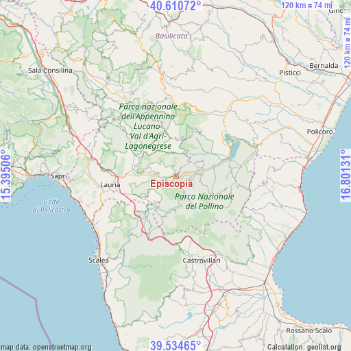
Episcopia GPS coordinates[2]
40° 4' 29.316" North, 16° 5' 53.448" East
| Map corner | latitude | longitude |
|---|---|---|
| Upper-left | 40.61072°, | 15.39506° |
| Center: | 40.07481°, | 16.09818° |
| Lower-right: | 39.53465°, | 16.80131° |
| Map W x H: | 119.6×119.6 km | = 74.3×74.3mi |
| max Lat: | 47.04031° ⇑87.4% North |
| Episcopia: | 40.07481° |
| min Lat: | ⇓12.6% South 35.50142° |
| min Long | Episcopia | max Long |
| 6.69888° | 16.09818° | 18.48682° |
| W 93.6%⇐ | ⇒6.4% E |
Elevation
Elevation of Episcopia is 528 m = 1732 ft, and this is 221.3 m = 726 ft above average elevation for this country.
| Max E: |
2085 m = 6841 ft | 19.8% |
| Episcopia | 528 m 1732 ft | |
| Avg. | 306.7 m = 1006 ft | |
Min E: |
-4 m = -13 ft | 80.2% |
See also: Italy elevation on elevation.city.
Geographical zone
Episcopia is located in North temperate zone (between Tropic of Cancer and the Arctic Circle). Distance of this Northern Tropic circle is 1850 km =1149.5 mi to South.| Distance of | km | miles | from Episcopia |
|---|---|---|---|
| North Pole | 5551.2 | 3449.4 | to North |
| Arctic Circle | 2945.3 | 1830.1 | to North |
| Tropic Cancer | 1850 | 1149.5 | to South |
| Equator | 4455.9 | 2768.8 | to South |


Nearby cities:
15 places around Episcopia: (largest is in red/bold)
• Calvera
9.1 km =5.7 mi,  25°
25°
• Carbone
7.5 km =4.7 mi,  353°
353°
• Castelluccio Inferiore
12.8 km =8 mi,  230°
230°
• Castelluccio Superiore
12.9 km =8 mi,  236°
236°
• Castelsaraceno
13.2 km =8.2 mi,  317°
317°
• Chiaromonte
11.3 km =7 mi,  61°
61°
• Fardella
7.5 km =4.7 mi,  54°
54°
• Francavilla in Sinni
9 km =5.6 mi,  85°
85°
• Latronico
7.7 km =4.8 mi,  281°
281°
• Magnano
4.3 km =2.7 mi, 239°
• Pedali
9.4 km =5.8 mi,  200°
200°
• San Chirico Raparo
13.2 km =8.2 mi, 351°
• San Severino Lucano
7 km =4.3 mi,  150°
150°
• Teana
7.3 km =4.5 mi,  39°
39°
• Viggianello
11.5 km =7.1 mi,  185°
185°
Sources, notices
• [Note1] Compared only with cities in Italy existing in our database
• [Src1] Map data: © OpenStreetMap contributors (CC-BY-SA)
• [Src2] Other city data from geonames.org with taken over terms of usage.
• [Src3] Geographical zone / Annual Mean Temperature by Robert A. Rohde @ Wikipedia
