Dogna geodata
Dogna (Friuli Venezia Giulia) is a seat of a third-order administrative division; located in Italy in Europe/Rome (GMT+2) time zone. With population of 100 people, there are 11438 cities with bigger population in this country. Compared to other cities in Italy, 98.1% of cities are located further ↓South; 71.6% of cities are located further ←West and 74.1% of cities have lower elevation than Dogna. Note1
Administrative division(s):
- Level 1: Friuli Venezia Giulia
- Level 2: Provincia di Udine
- Level 3: Dogna


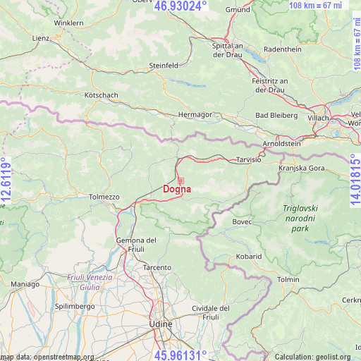
Dogna GPS coordinates[2]
46° 26' 52.548" North, 13° 18' 54.072" East
| Map corner | latitude | longitude |
|---|---|---|
| Upper-left | 46.93024°, | 12.6119° |
| Center: | 46.44793°, | 13.31502° |
| Lower-right: | 45.96131°, | 14.01815° |
| Map W x H: | 107.7×107.7 km | = 66.9×66.9mi |
| max Lat: | 47.04031° ⇑1.9% North |
| Dogna: | 46.44793° |
| min Lat: | ⇓98.1% South 35.50142° |
| min Long | Dogna | max Long |
| 6.69888° | 13.31502° | 18.48682° |
| W 71.6%⇐ | ⇒28.4% E |
Elevation
Elevation of Dogna is 440 m = 1444 ft, and this is 133.3 m = 437 ft above average elevation for this country.
| Max E: |
2085 m = 6841 ft | 25.9% |
| Dogna | 440 m 1444 ft | |
| Avg. | 306.7 m = 1006 ft | |
Min E: |
-4 m = -13 ft | 74.1% |
See also: Italy elevation on elevation.city.
Geographical zone
Dogna is located in North temperate zone (between Tropic of Cancer and the Arctic Circle). Distance of this North polar circle is 2236.6 km =1389.8 mi to North.| Distance of | km | miles | from Dogna |
|---|---|---|---|
| North Pole | 4842.5 | 3009 | to North |
| Arctic Circle | 2236.6 | 1389.8 | to North |
| Tropic Cancer | 2558.6 | 1589.8 | to South |
| Equator | 5164.5 | 3209.1 | to South |


Nearby cities:
15 places around Dogna: (largest is in red/bold)
• Amaro
18.9 km =11.7 mi,  244°
244°
• Bordano
21.8 km =13.5 mi,  227°
227°
• Camporosso in Valcanale
18.4 km =11.4 mi,  68°
68°
• Chiusaforte
4.6 km =2.9 mi,  189°
189°
• Ligosullo
21 km =13 mi,  299°
299°
• Lusevera
19.5 km =12.1 mi, 190°
• Malborghetto
11.6 km =7.2 mi,  55°
55°
• Moggio Udinese
9.6 km =6 mi, 244°
• Moggio di Sotto
10.3 km =6.4 mi, 243°
• Paularo
17.6 km =10.9 mi, 301°
• Pontebba
6.4 km =4 mi,  353°
353°
• Prato
8.3 km =5.2 mi,  184°
184°
• Resiutta
9.6 km =6 mi, 230°
• Tarvisio
21.8 km =13.5 mi, 72°
• Venzone
18.8 km =11.7 mi, 226°
Sources, notices
• [Note1] Compared only with cities in Italy existing in our database
• [Src1] Map data: © OpenStreetMap contributors (CC-BY-SA)
• [Src2] Other city data from geonames.org with taken over terms of usage.
• [Src3] Geographical zone / Annual Mean Temperature by Robert A. Rohde @ Wikipedia
