Cortemaggiore geodata
Cortemaggiore (Emilia-Romagna) is a seat of a third-order administrative division; located in Italy in Europe/Rome (GMT+2) time zone. With population of 3,659 people, there are 2579 cities with bigger population in this country. Compared to other cities in Italy, 59.7% of cities are located further ↓South; 68.5% of cities are located further →East and 79.3% of cities have higher elevation than Cortemaggiore. Note1
Administrative division(s):
- Level 1: Emilia-Romagna
- Level 2: Provincia di Piacenza
- Level 3: Cortemaggiore


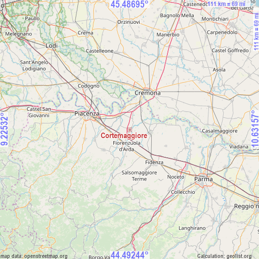
Cortemaggiore GPS coordinates[2]
44° 59' 30.66" North, 9° 55' 42.384" East
| Map corner | latitude | longitude |
|---|---|---|
| Upper-left | 45.48695°, | 9.22532° |
| Center: | 44.99185°, | 9.92844° |
| Lower-right: | 44.49244°, | 10.63157° |
| Map W x H: | 110.6×110.6 km | = 68.7×68.7mi |
| max Lat: | 47.04031° ⇑40.3% North |
| Cortemaggiore: | 44.99185° |
| min Lat: | ⇓59.7% South 35.50142° |
| min Long | Cortemaggiore | max Long |
| 6.69888° | 9.92844° | 18.48682° |
| W 31.5%⇐ | ⇒68.5% E |
Elevation
Elevation of Cortemaggiore is 53 m = 174 ft, and this is 253.7 m = 832 ft below average elevation for this country.
| Max E: |
2085 m = 6841 ft | 79.3% |
| Avg. | 306.7 m = 1006 ft | |
| Cortemaggiore | 53 m = 174 ft | |
Min E: |
-4 m = -13 ft | 20.7% |
See also: Italy elevation on elevation.city.
Geographical zone
Cortemaggiore is located in North temperate zone (between Tropic of Cancer and the Arctic Circle). Distance of this Northern Tropic circle is 2396.7 km =1489.2 mi to South.| Distance of | km | miles | from Cortemaggiore |
|---|---|---|---|
| North Pole | 5004.4 | 3109.6 | to North |
| Arctic Circle | 2398.5 | 1490.4 | to North |
| Tropic Cancer | 2396.7 | 1489.2 | to South |
| Equator | 5002.6 | 3108.5 | to South |


Nearby cities:
15 places around Cortemaggiore: (largest is in red/bold)
• Alseno
10.8 km =6.7 mi,  165°
165°
• Besenzone
2.2 km =1.4 mi,  104°
104°
• Busseto
9.1 km =5.7 mi, 98°
• Caorso
7.6 km =4.7 mi,  326°
326°
• Fiorenzuola d'Arda
7.6 km =4.7 mi,  189°
189°
• Lusurasco
11.5 km =7.1 mi, 187°
• Monticelli d'Ongina
10.8 km =6.7 mi,  2°
2°
• Olza-Fogarole
13 km =8.1 mi,  11°
11°
• Polesine Parmense
13 km =8.1 mi,  77°
77°
• Pontenure
10.8 km =6.7 mi,  273°
273°
• Roveleto
6.7 km =4.2 mi,  241°
241°
• San Giuliano
10.1 km =6.3 mi,  30°
30°
• San Nazzaro
9.7 km =6 mi,  346°
346°
• San Pietro in Cerro
3.7 km =2.3 mi, 27°
• Villanova
6.7 km =4.2 mi,  55°
55°
Sources, notices
• [Note1] Compared only with cities in Italy existing in our database
• [Src1] Map data: © OpenStreetMap contributors (CC-BY-SA)
• [Src2] Other city data from geonames.org with taken over terms of usage.
• [Src3] Geographical zone / Annual Mean Temperature by Robert A. Rohde @ Wikipedia
