Montan-Angelin-Arensod geodata
Montan-Angelin-Arensod (Aosta Valley) is a populated place; located in Italy in Europe/Rome (GMT+2) time zone. With population of 2,293 people, there are 3773 cities with bigger population in this country. Compared to other cities in Italy, 82.6% of cities are located further ↓South; 99.1% of cities are located further →East and 85.1% of cities have lower elevation than Montan-Angelin-Arensod. Note1
Current local time in Montan-Angelin-Arensod:
08:22 PM, WednesdayDifference from your time zone: hours


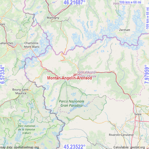
Montan-Angelin-Arensod GPS coordinates[2]
45° 43' 41.52" North, 7° 16' 35.292" East
| Map corner | latitude | longitude |
|---|---|---|
| Upper-left | 46.21687°, | 6.57334° |
| Center: | 45.7282°, | 7.27647° |
| Lower-right: | 45.23522°, | 7.97959° |
| Map W x H: | 109.1×109.1 km | = 67.8×67.8mi |
| max Lat: | 47.04031° ⇑17.4% North |
| Montan-Angelin-Arensod: | 45.7282° |
| min Lat: | ⇓82.6% South 35.50142° |
| min Long | Montan-Angelin- | max Long |
| 6.69888° | 7.27647° | 18.48682° |
| W 0.9%⇐ | ⇒99.1% E |
Elevation
Elevation of Montan-Angelin-Arensod is 614 m = 2014 ft, and this is 307.3 m = 1008 ft above average elevation for this country.
| Max E: |
2085 m = 6841 ft | 14.9% |
| Montan-Angelin-Arensod | 614 m 2014 ft | |
| Avg. | 306.7 m = 1006 ft | |
Min E: |
-4 m = -13 ft | 85.1% |
See also: Italy elevation on elevation.city.
Geographical zone
Montan-Angelin-Arensod is located in North temperate zone (between Tropic of Cancer and the Arctic Circle). Distance of this North polar circle is 2316.7 km =1439.5 mi to North.| Distance of | km | miles | from Montan-Angelin-Arensod |
|---|---|---|---|
| North Pole | 4922.6 | 3058.8 | to North |
| Arctic Circle | 2316.7 | 1439.5 | to North |
| Tropic Cancer | 2478.6 | 1540.1 | to South |
| Equator | 5084.5 | 3159.4 | to South |


Nearby cities:
15 places around Montan-Angelin-Arensod: (largest is in red/bold)
• Aosta
3.3 km =2.1 mi,  71°
71°
• Arpuilles
3.7 km =2.3 mi,  38°
38°
• Aymavilles
3.8 km =2.4 mi,  217°
217°
• Charvensod
3.8 km =2.4 mi,  103°
103°
• Gignod
6 km =3.7 mi,  15°
15°
• Gressan
1.5 km =0.9 mi,  123°
123°
• Jovencan
1.5 km =0.9 mi,  191°
191°
• Plan Felinaz-Felinaz
4.5 km =2.8 mi,  91°
91°
• Pollein
5.8 km =3.6 mi, 90°
• Pont Suaz-Ampaillant
3.3 km =2.1 mi, 92°
• Porossan
5 km =3.1 mi,  52°
52°
• Saint Maurice
2 km =1.2 mi,  234°
234°
• Saint-Pierre
4.3 km =2.7 mi,  244°
244°
• Variney Chez Roncoz
5.2 km =3.2 mi,  30°
30°
• Ville Sur Sarre
1.5 km =0.9 mi,  292°
292°
Sources, notices
• [Note1] Compared only with cities in Italy existing in our database
• [Src1] Map data: © OpenStreetMap contributors (CC-BY-SA)
• [Src2] Other city data from geonames.org with taken over terms of usage.
• [Src3] Geographical zone / Annual Mean Temperature by Robert A. Rohde @ Wikipedia
