Chiusa geodata
Chiusa (Trentino-Alto Adige) is a seat of a third-order administrative division; located in Italy in Europe/Rome (GMT+2) time zone. With population of 2,497 people, there are 3523 cities with bigger population in this country. Compared to other cities in Italy, 99.1% of cities are located further ↓South; 50.3% of cities are located further ←West and 80.7% of cities have lower elevation than Chiusa. Note1


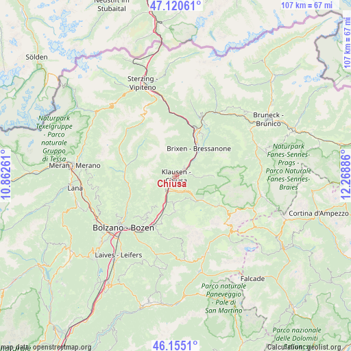
Chiusa GPS coordinates[2]
46° 38' 24.036" North, 11° 33' 56.628" East
| Map corner | latitude | longitude |
|---|---|---|
| Upper-left | 47.12061°, | 10.86261° |
| Center: | 46.64001°, | 11.56573° |
| Lower-right: | 46.1551°, | 12.26886° |
| Map W x H: | 107.4×107.4 km | = 66.7×66.7mi |
| max Lat: | 47.04031° ⇑0.9% North |
| Chiusa: | 46.64001° |
| min Lat: | ⇓99.1% South 35.50142° |
| min Long | Chiusa | max Long |
| 6.69888° | 11.56573° | 18.48682° |
| W 50.3%⇐ | ⇒49.7% E |
Elevation
Elevation of Chiusa is 535 m = 1755 ft, and this is 228.3 m = 749 ft above average elevation for this country.
| Max E: |
2085 m = 6841 ft | 19.3% |
| Chiusa | 535 m 1755 ft | |
| Avg. | 306.7 m = 1006 ft | |
Min E: |
-4 m = -13 ft | 80.7% |
See also: Italy elevation on elevation.city.
Geographical zone
Chiusa is located in North temperate zone (between Tropic of Cancer and the Arctic Circle). Distance of this North polar circle is 2215.3 km =1376.5 mi to North.| Distance of | km | miles | from Chiusa |
|---|---|---|---|
| North Pole | 4821.2 | 2995.8 | to North |
| Arctic Circle | 2215.3 | 1376.5 | to North |
| Tropic Cancer | 2580 | 1603.1 | to South |
| Equator | 5185.9 | 3222.4 | to South |


Nearby cities:
15 places around Chiusa: (largest is in red/bold)
• Albes
6.4 km =4 mi,  50°
50°
• Barbiano
5.2 km =3.2 mi,  220°
220°
• Barbiano - Barbian
5.3 km =3.3 mi, 219°
• Bressanone
10.8 km =6.7 mi,  39°
39°
• Castelrotto
8.2 km =5.1 mi,  182°
182°
• Funes - Villnoess
8.6 km =5.3 mi,  87°
87°
• Laion
3.5 km =2.2 mi, 180°
• Lazfons
3.5 km =2.2 mi,  341°
341°
• Ortisei
10.8 km =6.7 mi,  131°
131°
• Ponte Gardena
5.5 km =3.4 mi,  209°
209°
• San Pietro
8.9 km =5.5 mi, 89°
• Sant'Andrea in Monte
10.8 km =6.7 mi, 52°
• Velturno
3.8 km =2.4 mi, 38°
• Villandro
2.3 km =1.4 mi,  244°
244°
• Villandro - Villanders
2.4 km =1.5 mi, 244°
Sources, notices
• [Note1] Compared only with cities in Italy existing in our database
• [Src1] Map data: © OpenStreetMap contributors (CC-BY-SA)
• [Src2] Other city data from geonames.org with taken over terms of usage.
• [Src3] Geographical zone / Annual Mean Temperature by Robert A. Rohde @ Wikipedia
