Cereta geodata
Cereta (Lombardy) is a populated place; located in Italy in Europe/Rome (GMT+2) time zone. With population of 611 people, there are 8907 cities with bigger population in this country. Compared to other cities in Italy, 67.5% of cities are located further ↓South; 61.5% of cities are located further →East and 79.7% of cities have higher elevation than Cereta. Note1
Administrative division(s):
- Level 1: Lombardy
- Level 2: Provincia di Mantova
- Level 3: Volta Mantovana


Cereta GPS coordinates[2]
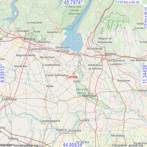
45° 18' 18.108" North, 10° 38' 28.5" East
| Map corner | latitude | longitude |
|---|---|---|
| Upper-left | 45.7974°, | 9.93813° |
| Center: | 45.30503°, | 10.64125° |
| Lower-right: | 44.80834°, | 11.34438° |
| Map W x H: | 110×110 km | = 68.4×68.4mi |
| max Lat: | 47.04031° ⇑32.5% North |
| Cereta: | 45.30503° |
| min Lat: | ⇓67.5% South 35.50142° |
| min Long | Cereta | max Long |
| 6.69888° | 10.64125° | 18.48682° |
| W 38.5%⇐ | ⇒61.5% E |
Elevation
Elevation of Cereta is 51 m = 167 ft, and this is 255.7 m = 839 ft below average elevation for this country.
| Max E: |
2085 m = 6841 ft | 79.7% |
| Avg. | 306.7 m = 1006 ft | |
| Cereta | 51 m = 167 ft | |
Min E: |
-4 m = -13 ft | 20.3% |
See also: Italy elevation on elevation.city.
Geographical zone
Cereta is located in North temperate zone (between Tropic of Cancer and the Arctic Circle). Distance of this North polar circle is 2363.7 km =1468.7 mi to North.| Distance of | km | miles | from Cereta |
|---|---|---|---|
| North Pole | 4969.6 | 3088 | to North |
| Arctic Circle | 2363.7 | 1468.7 | to North |
| Tropic Cancer | 2431.5 | 1510.9 | to South |
| Equator | 5037.4 | 3130.1 | to South |


Nearby cities:
15 places around Cereta: (largest is in red/bold)
• Cavriana
5.9 km =3.7 mi,  323°
323°
• Ceresara
7.4 km =4.6 mi,  229°
229°
• Cerlongo
3 km =1.9 mi,  167°
167°
• Goito
6.2 km =3.9 mi, 165°
• Guidizzolo
5.2 km =3.2 mi,  289°
289°
• Malavicina
11.4 km =7.1 mi,  93°
93°
• Medole
10.2 km =6.3 mi,  283°
283°
• Monzambano
9.8 km =6.1 mi,  24°
24°
• Pozzolengo
11.2 km =7 mi,  355°
355°
• Pozzolo
5.9 km =3.7 mi, 92°
• Roverbella
11 km =6.8 mi,  112°
112°
• Solferino
9.5 km =5.9 mi, 322°
• Valeggio sul Mincio
9.2 km =5.7 mi,  54°
54°
• Volta Mantovana
2.3 km =1.4 mi,  36°
36°
• Zona Artigianale Foroni
8.3 km =5.2 mi,  62°
62°
Sources, notices
• [Note1] Compared only with cities in Italy existing in our database
• [Src1] Map data: © OpenStreetMap contributors (CC-BY-SA)
• [Src2] Other city data from geonames.org with taken over terms of usage.
• [Src3] Geographical zone / Annual Mean Temperature by Robert A. Rohde @ Wikipedia
