Cordenons geodata
Cordenons (Friuli Venezia Giulia) is a seat of a third-order administrative division; located in Italy in Europe/Rome (GMT+2) time zone. With population of 15,962 people, there are 571 cities with bigger population in this country. Compared to other cities in Italy, 91.6% of cities are located further ↓South; 65% of cities are located further ←West and 82.7% of cities have higher elevation than Cordenons. Note1
Administrative division(s):
- Level 1: Friuli Venezia Giulia
- Level 2: Provincia di Pordenone
- Level 3: Cordenons


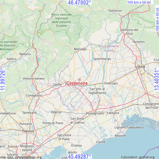
Cordenons GPS coordinates[2]
45° 59' 0.96" North, 12° 42' 1.368" East
| Map corner | latitude | longitude |
|---|---|---|
| Upper-left | 46.47002°, | 11.99726° |
| Center: | 45.9836°, | 12.70038° |
| Lower-right: | 45.49287°, | 13.40351° |
| Map W x H: | 108.6×108.6 km | = 67.5×67.5mi |
| max Lat: | 47.04031° ⇑8.4% North |
| Cordenons: | 45.9836° |
| min Lat: | ⇓91.6% South 35.50142° |
| min Long | Cordenons | max Long |
| 6.69888° | 12.70038° | 18.48682° |
| W 65%⇐ | ⇒35% E |
Elevation
Elevation of Cordenons is 39 m = 128 ft, and this is 267.7 m = 878 ft below average elevation for this country.
| Max E: |
2085 m = 6841 ft | 82.7% |
| Avg. | 306.7 m = 1006 ft | |
| Cordenons | 39 m = 128 ft | |
Min E: |
-4 m = -13 ft | 17.3% |
See also: Italy elevation on elevation.city.
Geographical zone
Cordenons is located in North temperate zone (between Tropic of Cancer and the Arctic Circle). Distance of this North polar circle is 2288.3 km =1421.9 mi to North.| Distance of | km | miles | from Cordenons |
|---|---|---|---|
| North Pole | 4894.2 | 3041.1 | to North |
| Arctic Circle | 2288.3 | 1421.9 | to North |
| Tropic Cancer | 2507 | 1557.8 | to South |
| Equator | 5112.9 | 3177 | to South |


Nearby cities:
15 places around Cordenons: (largest is in red/bold)
• Castions
7.8 km =4.8 mi,  99°
99°
• Ceolini
7.7 km =4.8 mi,  276°
276°
• Cinque Strade-Cimpello
7.4 km =4.6 mi,  180°
180°
• Fiume Veneto
6.8 km =4.2 mi,  154°
154°
• Musil
1.7 km =1.1 mi,  192°
192°
• Orcenico Inferiore
6.2 km =3.9 mi,  127°
127°
• Palse
8.4 km =5.2 mi,  240°
240°
• Porcia
6.9 km =4.3 mi,  250°
250°
• Pordenone
4.3 km =2.7 mi,  226°
226°
• Roveredo in Piano
6.8 km =4.2 mi,  293°
293°
• San Foca
8.4 km =5.2 mi,  356°
356°
• San Quirino
5.9 km =3.7 mi,  343°
343°
• Sedrano
8.1 km =5 mi, 340°
• Villa D'Arco
3.2 km =2 mi,  303°
303°
• Zoppola
5.6 km =3.5 mi,  110°
110°
Sources, notices
• [Note1] Compared only with cities in Italy existing in our database
• [Src1] Map data: © OpenStreetMap contributors (CC-BY-SA)
• [Src2] Other city data from geonames.org with taken over terms of usage.
• [Src3] Geographical zone / Annual Mean Temperature by Robert A. Rohde @ Wikipedia
