Castiglione geodata
Castiglione (Liguria) is a seat of a third-order administrative division; located in Italy in Europe/Rome (GMT+2) time zone. With population of 466 people, there are 10033 cities with bigger population in this country. Compared to other cities in Italy, 52.1% of cities are located further ↑North; 73% of cities are located further →East and 56.2% of cities have lower elevation than Castiglione. Note1
Administrative division(s):
- Level 1: Liguria
- Level 2: Provincia di Genova
- Level 3: Castiglione Chiavarese


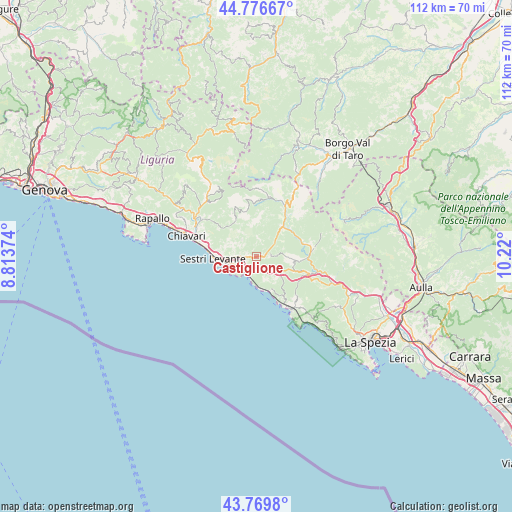
Castiglione GPS coordinates[2]
44° 16' 31.404" North, 9° 31' 0.732" East
| Map corner | latitude | longitude |
|---|---|---|
| Upper-left | 44.77667°, | 8.81374° |
| Center: | 44.27539°, | 9.51687° |
| Lower-right: | 43.7698°, | 10.22° |
| Map W x H: | 112×112 km | = 69.6×69.6mi |
| max Lat: | 47.04031° ⇑52.1% North |
| Castiglione: | 44.27539° |
| min Lat: | ⇓47.9% South 35.50142° |
| min Long | Castiglione | max Long |
| 6.69888° | 9.51687° | 18.48682° |
| W 27%⇐ | ⇒73% E |
Elevation
Elevation of Castiglione is 273 m = 896 ft, and this is 33.7 m = 111 ft below average elevation for this country.
| Max E: |
2085 m = 6841 ft | 43.8% |
| Avg. | 306.7 m = 1006 ft | |
| Castiglione | 273 m = 896 ft | |
Min E: |
-4 m = -13 ft | 56.2% |
See also: Italy elevation on elevation.city.
Geographical zone
Castiglione is located in North temperate zone (between Tropic of Cancer and the Arctic Circle). Distance of this Northern Tropic circle is 2317 km =1439.7 mi to South.| Distance of | km | miles | from Castiglione |
|---|---|---|---|
| North Pole | 5084.1 | 3159.1 | to North |
| Arctic Circle | 2478.2 | 1539.9 | to North |
| Tropic Cancer | 2317 | 1439.7 | to South |
| Equator | 4923 | 3059 | to South |


Nearby cities:
15 places around Castiglione: (largest is in red/bold)
• Bonassola
11.6 km =7.2 mi,  152°
152°
• Carro
7.3 km =4.5 mi,  92°
92°
• Carrodano
11.7 km =7.3 mi,  108°
108°
• Casarza Ligure
5.6 km =3.5 mi,  265°
265°
• Cogorno
12.6 km =7.8 mi,  293°
293°
• Conscenti
12.4 km =7.7 mi,  308°
308°
• Deiva Marina
6.2 km =3.9 mi,  177°
177°
• Framura
7.9 km =4.9 mi,  158°
158°
• Lavagna
13.4 km =8.3 mi,  284°
284°
• Levanto
13.8 km =8.6 mi,  144°
144°
• Maissana
7 km =4.3 mi,  12°
12°
• Moneglia
4.5 km =2.8 mi,  207°
207°
• Sesta Godano
12.8 km =8 mi,  80°
80°
• Sestri Levante
9.6 km =6 mi, 268°
• Varese Ligure
12.8 km =8 mi,  28°
28°
Sources, notices
• [Note1] Compared only with cities in Italy existing in our database
• [Src1] Map data: © OpenStreetMap contributors (CC-BY-SA)
• [Src2] Other city data from geonames.org with taken over terms of usage.
• [Src3] Geographical zone / Annual Mean Temperature by Robert A. Rohde @ Wikipedia
