Varese Ligure geodata
Varese Ligure (Liguria) is a seat of a third-order administrative division; located in Italy in Europe/Rome (GMT+2) time zone. With population of 525 people, there are 9685 cities with bigger population in this country. Compared to other cities in Italy, 50.8% of cities are located further ↑North; 72.1% of cities are located further →East and 66.5% of cities have lower elevation than Varese Ligure. Note1


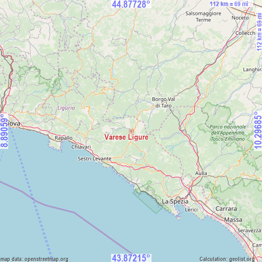
Varese Ligure GPS coordinates[2]
44° 22' 36.732" North, 9° 35' 37.392" East
| Map corner | latitude | longitude |
|---|---|---|
| Upper-left | 44.87728°, | 8.89059° |
| Center: | 44.37687°, | 9.59372° |
| Lower-right: | 43.87215°, | 10.29685° |
| Map W x H: | 111.8×111.8 km | = 69.5×69.5mi |
| max Lat: | 47.04031° ⇑50.8% North |
| Varese Ligure: | 44.37687° |
| min Lat: | ⇓49.2% South 35.50142° |
| min Long | Varese Ligure | max Long |
| 6.69888° | 9.59372° | 18.48682° |
| W 27.9%⇐ | ⇒72.1% E |
Elevation
Elevation of Varese Ligure is 358 m = 1175 ft, and this is 51.3 m = 168 ft above average elevation for this country.
| Max E: |
2085 m = 6841 ft | 33.5% |
| Varese Ligure | 358 m 1175 ft | |
| Avg. | 306.7 m = 1006 ft | |
Min E: |
-4 m = -13 ft | 66.5% |
See also: Italy elevation on elevation.city.
Geographical zone
Varese Ligure is located in North temperate zone (between Tropic of Cancer and the Arctic Circle). Distance of this Northern Tropic circle is 2328.3 km =1446.7 mi to South.| Distance of | km | miles | from Varese Ligure |
|---|---|---|---|
| North Pole | 5072.8 | 3152.1 | to North |
| Arctic Circle | 2466.9 | 1532.9 | to North |
| Tropic Cancer | 2328.3 | 1446.7 | to South |
| Equator | 4934.2 | 3066 | to South |


Nearby cities:
15 places around Varese Ligure: (largest is in red/bold)
• Albareto
11.6 km =7.2 mi,  47°
47°
• Bedonia
14.5 km =9 mi,  13°
13°
• Borzonasca
17 km =10.6 mi,  286°
286°
• Carro
11.7 km =7.3 mi,  174°
174°
• Carrodano
15.8 km =9.8 mi,  161°
161°
• Casarza Ligure
16.5 km =10.3 mi,  224°
224°
• Castiglione
12.8 km =8 mi,  208°
208°
• Compiano
14.3 km =8.9 mi,  22°
22°
• Conscenti
16.2 km =10.1 mi,  257°
257°
• Maissana
6.4 km =4 mi,  225°
225°
• Patigno
13.7 km =8.5 mi,  101°
101°
• Pieve di Zignago
16.3 km =10.1 mi,  132°
132°
• Sesta Godano
11.3 km =7 mi,  144°
144°
• Tornolo
12.3 km =7.6 mi, 12°
• Zeri
13.7 km =8.5 mi, 100°
Sources, notices
• [Note1] Compared only with cities in Italy existing in our database
• [Src1] Map data: © OpenStreetMap contributors (CC-BY-SA)
• [Src2] Other city data from geonames.org with taken over terms of usage.
• [Src3] Geographical zone / Annual Mean Temperature by Robert A. Rohde @ Wikipedia
