Carenno geodata
Carenno (Lombardy) is a seat of a third-order administrative division; located in Italy in Europe/Rome (GMT+2) time zone. With population of 1,391 people, there are 5384 cities with bigger population in this country. Compared to other cities in Italy, 85.8% of cities are located further ↓South; 73.7% of cities are located further →East and 86.7% of cities have lower elevation than Carenno. Note1


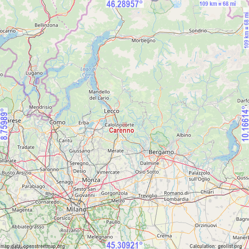
Carenno GPS coordinates[2]
45° 48' 5.58" North, 9° 27' 46.836" East
| Map corner | latitude | longitude |
|---|---|---|
| Upper-left | 46.28957°, | 8.75989° |
| Center: | 45.80155°, | 9.46301° |
| Lower-right: | 45.30921°, | 10.16614° |
| Map W x H: | 109×109 km | = 67.7×67.7mi |
| max Lat: | 47.04031° ⇑14.2% North |
| Carenno: | 45.80155° |
| min Lat: | ⇓85.8% South 35.50142° |
| min Long | Carenno | max Long |
| 6.69888° | 9.46301° | 18.48682° |
| W 26.3%⇐ | ⇒73.7% E |
Elevation
Elevation of Carenno is 647 m = 2123 ft, and this is 340.3 m = 1116 ft above average elevation for this country.
| Max E: |
2085 m = 6841 ft | 13.3% |
| Carenno | 647 m 2123 ft | |
| Avg. | 306.7 m = 1006 ft | |
Min E: |
-4 m = -13 ft | 86.7% |
See also: Italy elevation on elevation.city.
Geographical zone
Carenno is located in North temperate zone (between Tropic of Cancer and the Arctic Circle). Distance of this North polar circle is 2308.5 km =1434.4 mi to North.| Distance of | km | miles | from Carenno |
|---|---|---|---|
| North Pole | 4914.4 | 3053.7 | to North |
| Arctic Circle | 2308.5 | 1434.4 | to North |
| Tropic Cancer | 2486.7 | 1545.2 | to South |
| Equator | 5092.7 | 3164.5 | to South |


Nearby cities:
15 places around Carenno: (largest is in red/bold)
• Calchera-Frontale
5.2 km =3.2 mi,  46°
46°
• Calolziocorte
2.1 km =1.3 mi,  250°
250°
• Costa Valle Imagna
3.2 km =2 mi,  87°
87°
• Erve
2.4 km =1.5 mi,  340°
340°
• Favirano
2.2 km =1.4 mi,  197°
197°
• Garlate
5 km =3.1 mi,  283°
283°
• Monte Marenzo
3.3 km =2.1 mi,  191°
191°
• Olginate
3.6 km =2.2 mi, 251°
• Rota d'Imagna
5 km =3.1 mi, 49°
• Sant'Antonio
5.2 km =3.2 mi,  161°
161°
• Sant'Omobono Terme
5.7 km =3.5 mi,  82°
82°
• Selino Basso
5.7 km =3.5 mi, 80°
• Torre de' Busi
3.3 km =2.1 mi, 156°
• Valgreghentino
4.6 km =2.9 mi,  237°
237°
• Vercurago
3.3 km =2.1 mi,  285°
285°
Sources, notices
• [Note1] Compared only with cities in Italy existing in our database
• [Src1] Map data: © OpenStreetMap contributors (CC-BY-SA)
• [Src2] Other city data from geonames.org with taken over terms of usage.
• [Src3] Geographical zone / Annual Mean Temperature by Robert A. Rohde @ Wikipedia
