Cantalupo geodata
Cantalupo (Piedmont) is a populated place; located in Italy in Europe/Rome (GMT+2) time zone. With population of 990 people, there are 6711 cities with bigger population in this country. Compared to other cities in Italy, 57.4% of cities are located further ↓South; 87.3% of cities are located further →East and 69.6% of cities have higher elevation than Cantalupo. Note1
Administrative division(s):
- Level 1: Piedmont
- Level 2: Provincia di Alessandria
- Level 3: Alessandria


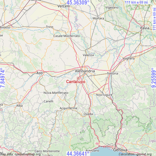
Cantalupo GPS coordinates[2]
44° 52' 0.876" North, 8° 33' 10.296" East
| Map corner | latitude | longitude |
|---|---|---|
| Upper-left | 45.36309°, | 7.84974° |
| Center: | 44.86691°, | 8.55286° |
| Lower-right: | 44.36641°, | 9.25599° |
| Map W x H: | 110.8×110.8 km | = 68.8×68.8mi |
| max Lat: | 47.04031° ⇑42.6% North |
| Cantalupo: | 44.86691° |
| min Lat: | ⇓57.4% South 35.50142° |
| min Long | Cantalupo | max Long |
| 6.69888° | 8.55286° | 18.48682° |
| W 12.7%⇐ | ⇒87.3% E |
Elevation
Elevation of Cantalupo is 100 m = 328 ft, and this is 206.7 m = 678 ft below average elevation for this country.
| Max E: |
2085 m = 6841 ft | 69.6% |
| Avg. | 306.7 m = 1006 ft | |
| Cantalupo | 100 m = 328 ft | |
Min E: |
-4 m = -13 ft | 30.4% |
See also: Italy elevation on elevation.city.
Geographical zone
Cantalupo is located in North temperate zone (between Tropic of Cancer and the Arctic Circle). Distance of this Northern Tropic circle is 2382.8 km =1480.6 mi to South.| Distance of | km | miles | from Cantalupo |
|---|---|---|---|
| North Pole | 5018.3 | 3118.2 | to North |
| Arctic Circle | 2412.4 | 1499 | to North |
| Tropic Cancer | 2382.8 | 1480.6 | to South |
| Equator | 4988.7 | 3099.8 | to South |


Nearby cities:
15 places around Cantalupo: (largest is in red/bold)
• Alessandria
6.5 km =4 mi,  43°
43°
• Bergamasco
8.9 km =5.5 mi,  240°
240°
• Borgoratto Alessandrino
3.6 km =2.2 mi,  198°
198°
• Cabanette
2.7 km =1.7 mi,  49°
49°
• Carentino
7.7 km =4.8 mi, 236°
• Casal Cermelli
6.7 km =4.2 mi,  122°
122°
• Casalbagliano
3.6 km =2.2 mi,  18°
18°
• Castellazzo Bormida
3.3 km =2.1 mi,  141°
141°
• Castelspina
7.2 km =4.5 mi,  160°
160°
• Frascaro
4.9 km =3 mi, 200°
• Gamalero
6.6 km =4.1 mi,  188°
188°
• Oviglio
5.2 km =3.2 mi,  263°
263°
• San Michele
7.2 km =4.5 mi, 17°
• Sezzadio
9.3 km =5.8 mi,  170°
170°
• Solero
6.7 km =4.2 mi,  328°
328°
Sources, notices
• [Note1] Compared only with cities in Italy existing in our database
• [Src1] Map data: © OpenStreetMap contributors (CC-BY-SA)
• [Src2] Other city data from geonames.org with taken over terms of usage.
• [Src3] Geographical zone / Annual Mean Temperature by Robert A. Rohde @ Wikipedia
