Calavino geodata
Calavino (Trentino-Alto Adige) is a seat of a third-order administrative division; located in Italy in Europe/Rome (GMT+2) time zone. With population of 824 people, there are 7530 cities with bigger population in this country. Compared to other cities in Italy, 93% of cities are located further ↓South; 57.5% of cities are located further →East and 70.9% of cities have lower elevation than Calavino. Note1
Administrative division(s):
- Level 1: Trentino-Alto Adige
- Level 2: Provincia autonoma di Trento
- Level 3: Madruzzo


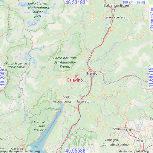
Calavino GPS coordinates[2]
46° 2' 45.816" North, 10° 59' 2.472" East
| Map corner | latitude | longitude |
|---|---|---|
| Upper-left | 46.53193°, | 10.2809° |
| Center: | 46.04606°, | 10.98402° |
| Lower-right: | 45.55588°, | 11.68715° |
| Map W x H: | 108.5×108.5 km | = 67.4×67.4mi |
| max Lat: | 47.04031° ⇑7% North |
| Calavino: | 46.04606° |
| min Lat: | ⇓93% South 35.50142° |
| min Long | Calavino | max Long |
| 6.69888° | 10.98402° | 18.48682° |
| W 42.5%⇐ | ⇒57.5% E |
Elevation
Elevation of Calavino is 403 m = 1322 ft, and this is 96.3 m = 316 ft above average elevation for this country.
| Max E: |
2085 m = 6841 ft | 29.1% |
| Calavino | 403 m 1322 ft | |
| Avg. | 306.7 m = 1006 ft | |
Min E: |
-4 m = -13 ft | 70.9% |
See also: Italy elevation on elevation.city.
Geographical zone
Calavino is located in North temperate zone (between Tropic of Cancer and the Arctic Circle). Distance of this North polar circle is 2281.3 km =1417.5 mi to North.| Distance of | km | miles | from Calavino |
|---|---|---|---|
| North Pole | 4887.2 | 3036.8 | to North |
| Arctic Circle | 2281.3 | 1417.5 | to North |
| Tropic Cancer | 2513.9 | 1562.1 | to South |
| Equator | 5119.8 | 3181.3 | to South |


Nearby cities:
15 places around Calavino: (largest is in red/bold)
• Cadine
8.1 km =5 mi,  53°
53°
• Cavedine
5.7 km =3.5 mi,  188°
188°
• Dorsino
7.3 km =4.5 mi,  293°
293°
• Drena
9 km =5.6 mi,  199°
199°
• Garniga Nuova
9.3 km =5.8 mi,  120°
120°
• Lasino
2.4 km =1.5 mi,  180°
180°
• Padergnone
1.5 km =0.9 mi,  2°
2°
• Pietramurata
4.3 km =2.7 mi,  227°
227°
• Ponte Arche
8.6 km =5.3 mi,  262°
262°
• San Lorenzo in Banale
6.7 km =4.2 mi,  300°
300°
• Sarche
2.4 km =1.5 mi,  274°
274°
• Sardagna
8.9 km =5.5 mi,  76°
76°
• Terlago
7.4 km =4.6 mi,  39°
39°
• Vezzano
3.8 km =2.4 mi,  15°
15°
• Vigo
7.5 km =4.7 mi, 182°
Sources, notices
• [Note1] Compared only with cities in Italy existing in our database
• [Src1] Map data: © OpenStreetMap contributors (CC-BY-SA)
• [Src2] Other city data from geonames.org with taken over terms of usage.
• [Src3] Geographical zone / Annual Mean Temperature by Robert A. Rohde @ Wikipedia
