Vezzano geodata
Vezzano (Trentino-Alto Adige) is a seat of a third-order administrative division; located in Italy in Europe/Rome (GMT+2) time zone. With population of 1,239 people, there are 5830 cities with bigger population in this country. Compared to other cities in Italy, 93.6% of cities are located further ↓South; 57.4% of cities are located further →East and 68.7% of cities have lower elevation than Vezzano. Note1
Administrative division(s):
- Level 1: Trentino-Alto Adige
- Level 2: Provincia autonoma di Trento
- Level 3: Vallelaghi


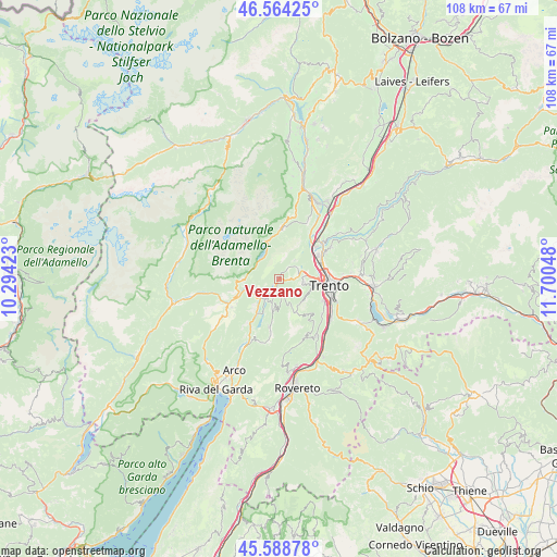
Vezzano GPS coordinates[2]
46° 4' 43.212" North, 10° 59' 50.46" East
| Map corner | latitude | longitude |
|---|---|---|
| Upper-left | 46.56425°, | 10.29423° |
| Center: | 46.07867°, | 10.99735° |
| Lower-right: | 45.58878°, | 11.70048° |
| Map W x H: | 108.5×108.5 km | = 67.4×67.4mi |
| max Lat: | 47.04031° ⇑6.4% North |
| Vezzano: | 46.07867° |
| min Lat: | ⇓93.6% South 35.50142° |
| min Long | Vezzano | max Long |
| 6.69888° | 10.99735° | 18.48682° |
| W 42.6%⇐ | ⇒57.4% E |
Elevation
Elevation of Vezzano is 381 m = 1250 ft, and this is 74.3 m = 244 ft above average elevation for this country.
| Max E: |
2085 m = 6841 ft | 31.3% |
| Vezzano | 381 m 1250 ft | |
| Avg. | 306.7 m = 1006 ft | |
Min E: |
-4 m = -13 ft | 68.7% |
See also: Italy elevation on elevation.city.
Geographical zone
Vezzano is located in North temperate zone (between Tropic of Cancer and the Arctic Circle). Distance of this North polar circle is 2277.7 km =1415.3 mi to North.| Distance of | km | miles | from Vezzano |
|---|---|---|---|
| North Pole | 4883.6 | 3034.5 | to North |
| Arctic Circle | 2277.7 | 1415.3 | to North |
| Tropic Cancer | 2517.5 | 1564.3 | to South |
| Equator | 5123.5 | 3183.6 | to South |


Nearby cities:
15 places around Vezzano: (largest is in red/bold)
• Andalo
9.8 km =6.1 mi,  3°
3°
• Cadine
5.6 km =3.5 mi,  77°
77°
• Calavino
3.8 km =2.4 mi,  195°
195°
• Cavedine
9.5 km =5.9 mi,  191°
191°
• Dorsino
7.7 km =4.8 mi,  265°
265°
• Lasino
6.1 km =3.8 mi, 189°
• Molveno
7.6 km =4.7 mi,  339°
339°
• Padergnone
2.3 km =1.4 mi, 204°
• Pietramurata
7.7 km =4.8 mi,  212°
212°
• San Lorenzo in Banale
6.9 km =4.3 mi, 268°
• Sarche
4.8 km =3 mi,  224°
224°
• Sardagna
7.8 km =4.8 mi,  102°
102°
• Terlago
4.2 km =2.6 mi,  60°
60°
• Trento
9.6 km =6 mi, 97°
• Vela
8.1 km =5 mi,  87°
87°
Sources, notices
• [Note1] Compared only with cities in Italy existing in our database
• [Src1] Map data: © OpenStreetMap contributors (CC-BY-SA)
• [Src2] Other city data from geonames.org with taken over terms of usage.
• [Src3] Geographical zone / Annual Mean Temperature by Robert A. Rohde @ Wikipedia
