San Lorenzo in Banale geodata
San Lorenzo in Banale (Trentino-Alto Adige) is a seat of a third-order administrative division; located in Italy in Europe/Rome (GMT+2) time zone. With population of 1,109 people, there are 6259 cities with bigger population in this country. Compared to other cities in Italy, 93.6% of cities are located further ↓South; 58.4% of cities are located further →East and 90.4% of cities have lower elevation than San Lorenzo in Banale. Note1
Administrative division(s):
- Level 1: Trentino-Alto Adige
- Level 2: Provincia autonoma di Trento
- Level 3: San Lorenzo Dorsino
Current local time in San Lorenzo in Banale:
08:15 PM, WednesdayDifference from your time zone: hours


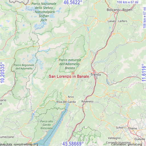
San Lorenzo in Banale GPS coordinates[2]
46° 4' 35.76" North, 10° 54' 30.492" East
| Map corner | latitude | longitude |
|---|---|---|
| Upper-left | 46.5622°, | 10.20535° |
| Center: | 46.0766°, | 10.90847° |
| Lower-right: | 45.58669°, | 11.6116° |
| Map W x H: | 108.5×108.5 km | = 67.4×67.4mi |
| max Lat: | 47.04031° ⇑6.4% North |
| San Lorenzo in Banale: | 46.0766° |
| min Lat: | ⇓93.6% South 35.50142° |
| min Long | San Lorenzo in | max Long |
| 6.69888° | 10.90847° | 18.48682° |
| W 41.6%⇐ | ⇒58.4% E |
Elevation
Elevation of San Lorenzo in Banale is 729 m = 2392 ft, and this is 422.3 m = 1385 ft above average elevation for this country.
| Max E: |
2085 m = 6841 ft | 9.6% |
| San Lorenzo in Banale | 729 m 2392 ft | |
| Avg. | 306.7 m = 1006 ft | |
Min E: |
-4 m = -13 ft | 90.4% |
See also: Italy elevation on elevation.city.
Geographical zone
San Lorenzo in Banale is located in North temperate zone (between Tropic of Cancer and the Arctic Circle). Distance of this North polar circle is 2277.9 km =1415.4 mi to North.| Distance of | km | miles | from San Lorenzo in Banale |
|---|---|---|---|
| North Pole | 4883.8 | 3034.7 | to North |
| Arctic Circle | 2277.9 | 1415.4 | to North |
| Tropic Cancer | 2517.3 | 1564.2 | to South |
| Equator | 5123.2 | 3183.4 | to South |


Nearby cities:
15 places around San Lorenzo in Banale: (largest is in red/bold)
• Bleggio Superiore
7.9 km =4.9 mi,  223°
223°
• Calavino
6.7 km =4.2 mi,  120°
120°
• Cavedine
10.4 km =6.5 mi,  150°
150°
• Dorsino
1 km =0.6 mi,  243°
243°
• Fiavè
9.5 km =5.9 mi,  212°
212°
• Lasino
8.2 km =5.1 mi,  135°
135°
• Molveno
8.4 km =5.2 mi,  29°
29°
• Padergnone
6.2 km =3.9 mi,  107°
107°
• Pietramurata
6.8 km =4.2 mi,  156°
156°
• Ponte Arche
5.3 km =3.3 mi, 210°
• Ragoli
10.3 km =6.4 mi,  256°
256°
• Sarche
4.7 km =2.9 mi,  132°
132°
• Stenico
5 km =3.1 mi, 235°
• Terlago
10.8 km =6.7 mi,  77°
77°
• Vezzano
6.9 km =4.3 mi,  88°
88°
Sources, notices
• [Note1] Compared only with cities in Italy existing in our database
• [Src1] Map data: © OpenStreetMap contributors (CC-BY-SA)
• [Src2] Other city data from geonames.org with taken over terms of usage.
• [Src3] Geographical zone / Annual Mean Temperature by Robert A. Rohde @ Wikipedia
