Borgonuovo geodata
Borgonuovo (Emilia-Romagna) is a populated place; located in Italy in Europe/Rome (GMT+2) time zone. With population of 4,217 people, there are 2275 cities with bigger population in this country. Compared to other cities in Italy, 50.1% of cities are located further ↓South; 53.5% of cities are located further →East and 69.3% of cities have higher elevation than Borgonuovo. Note1


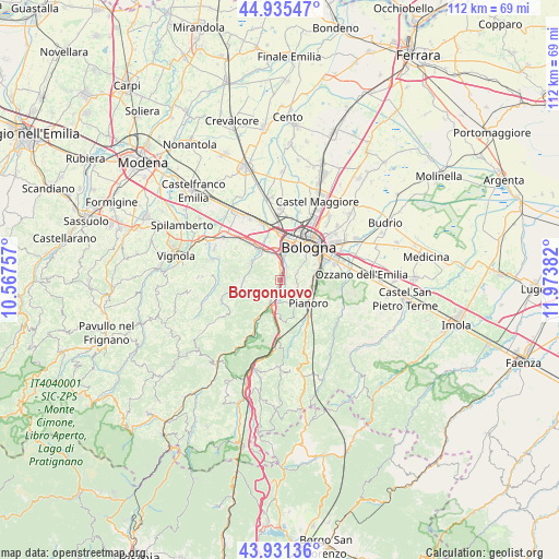
Borgonuovo GPS coordinates[2]
44° 26' 8.052" North, 11° 16' 14.484" East
| Map corner | latitude | longitude |
|---|---|---|
| Upper-left | 44.93547°, | 10.56757° |
| Center: | 44.43557°, | 11.27069° |
| Lower-right: | 43.93136°, | 11.97382° |
| Map W x H: | 111.6×111.6 km | = 69.3×69.3mi |
| max Lat: | 47.04031° ⇑49.9% North |
| Borgonuovo: | 44.43557° |
| min Lat: | ⇓50.1% South 35.50142° |
| min Long | Borgonuovo | max Long |
| 6.69888° | 11.27069° | 18.48682° |
| W 46.5%⇐ | ⇒53.5% E |
Elevation
Elevation of Borgonuovo is 101 m = 331 ft, and this is 205.7 m = 675 ft below average elevation for this country.
| Max E: |
2085 m = 6841 ft | 69.3% |
| Avg. | 306.7 m = 1006 ft | |
| Borgonuovo | 101 m = 331 ft | |
Min E: |
-4 m = -13 ft | 30.7% |
See also: Italy elevation on elevation.city.
Geographical zone
Borgonuovo is located in North temperate zone (between Tropic of Cancer and the Arctic Circle). Distance of this Northern Tropic circle is 2334.9 km =1450.8 mi to South.| Distance of | km | miles | from Borgonuovo |
|---|---|---|---|
| North Pole | 5066.3 | 3148.1 | to North |
| Arctic Circle | 2460.4 | 1528.8 | to North |
| Tropic Cancer | 2334.9 | 1450.8 | to South |
| Equator | 4940.8 | 3070.1 | to South |


Nearby cities:
15 places around Borgonuovo: (largest is in red/bold)
• Bologna
8.4 km =5.2 mi,  39°
39°
• Calderino
6.2 km =3.9 mi,  293°
293°
• Casalecchio di Reno
4.5 km =2.8 mi,  4°
4°
• Fontana
6.3 km =3.9 mi,  204°
204°
• Lama di Reno
8.8 km =5.5 mi,  209°
209°
• Martiri di Pizzocalvo
10.2 km =6.3 mi,  81°
81°
• Monte San Giovanni
8 km =5 mi,  257°
257°
• Pianoro
7.7 km =4.8 mi,  132°
132°
• Ponte Ronca
9.8 km =6.1 mi,  318°
318°
• Ponticella
8.8 km =5.5 mi, 76°
• Rastignano-Carteria di Sesto
6.8 km =4.2 mi,  89°
89°
• Riale
6.1 km =3.8 mi,  330°
330°
• Sasso Marconi
4.2 km =2.6 mi, 201°
• Trappolone
7.4 km =4.6 mi, 79°
• Zola Predosa
7.3 km =4.5 mi, 325°
Sources, notices
• [Note1] Compared only with cities in Italy existing in our database
• [Src1] Map data: © OpenStreetMap contributors (CC-BY-SA)
• [Src2] Other city data from geonames.org with taken over terms of usage.
• [Src3] Geographical zone / Annual Mean Temperature by Robert A. Rohde @ Wikipedia
