Borello geodata
Borello (Emilia-Romagna) is a populated place; located in Italy in Europe/Rome (GMT+2) time zone. With population of 1,945 people, there are 4257 cities with bigger population in this country. Compared to other cities in Italy, 54.1% of cities are located further ↑North; 58.4% of cities are located further ←West and 70.2% of cities have higher elevation than Borello. Note1
Administrative division(s):
- Level 1: Emilia-Romagna
- Level 2: Provincia di Forlì-Cesena
- Level 3: Cesena


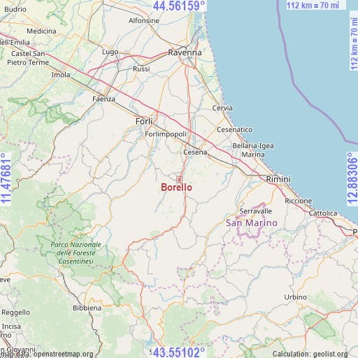
Borello GPS coordinates[2]
44° 3' 30.456" North, 12° 10' 47.748" East
| Map corner | latitude | longitude |
|---|---|---|
| Upper-left | 44.56159°, | 11.47681° |
| Center: | 44.05846°, | 12.17993° |
| Lower-right: | 43.55102°, | 12.88306° |
| Map W x H: | 112.4×112.4 km | = 69.8×69.8mi |
| max Lat: | 47.04031° ⇑54.1% North |
| Borello: | 44.05846° |
| min Lat: | ⇓45.9% South 35.50142° |
| min Long | Borello | max Long |
| 6.69888° | 12.17993° | 18.48682° |
| W 58.4%⇐ | ⇒41.6% E |
Elevation
Elevation of Borello is 96 m = 315 ft, and this is 210.7 m = 691 ft below average elevation for this country.
| Max E: |
2085 m = 6841 ft | 70.2% |
| Avg. | 306.7 m = 1006 ft | |
| Borello | 96 m = 315 ft | |
Min E: |
-4 m = -13 ft | 29.8% |
See also: Italy elevation on elevation.city.
Geographical zone
Borello is located in North temperate zone (between Tropic of Cancer and the Arctic Circle). Distance of this Northern Tropic circle is 2292.9 km =1424.7 mi to South.| Distance of | km | miles | from Borello |
|---|---|---|---|
| North Pole | 5108.2 | 3174.1 | to North |
| Arctic Circle | 2502.3 | 1554.9 | to North |
| Tropic Cancer | 2292.9 | 1424.7 | to South |
| Equator | 4898.8 | 3044 | to South |


Nearby cities:
15 places around Borello: (largest is in red/bold)
• Bertinoro
10.6 km =6.6 mi,  340°
340°
• Bora Bassa
1.3 km =0.8 mi,  177°
177°
• Capocolle
11.8 km =7.3 mi,  358°
358°
• Cesena
10.3 km =6.4 mi,  29°
29°
• Fratta Terme
11.1 km =6.9 mi,  326°
326°
• Gualdo
4.5 km =2.8 mi,  153°
153°
• Longiano
12.1 km =7.5 mi,  81°
81°
• Meldola
12.1 km =7.5 mi,  309°
309°
• Mercato Saraceno
10.7 km =6.6 mi,  172°
172°
• Monte Castello
12.2 km =7.6 mi, 178°
• Montiano
10.3 km =6.4 mi, 75°
• Roncofreddo
9.8 km =6.1 mi,  100°
100°
• Roncofreddo-Santa Paola
11 km =6.8 mi, 99°
• San Colombano
11.3 km =7 mi,  292°
292°
• Sogliano al Rubicone
11.4 km =7.1 mi,  121°
121°
Sources, notices
• [Note1] Compared only with cities in Italy existing in our database
• [Src1] Map data: © OpenStreetMap contributors (CC-BY-SA)
• [Src2] Other city data from geonames.org with taken over terms of usage.
• [Src3] Geographical zone / Annual Mean Temperature by Robert A. Rohde @ Wikipedia
