Sover geodata
Sover (Trentino-Alto Adige) is a seat of a third-order administrative division; located in Italy in Europe/Rome (GMT+2) time zone. With population of 270 people, there are 10803 cities with bigger population in this country. Compared to other cities in Italy, 96.2% of cities are located further ↓South; 52.9% of cities are located further →East and 94.2% of cities have lower elevation than Sover. Note1
Administrative division(s):
- Level 1: Trentino-Alto Adige
- Level 2: Provincia autonoma di Trento
- Level 3: Sover


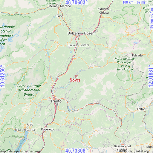
Sover GPS coordinates[2]
46° 13' 18.156" North, 11° 18' 56.448" East
| Map corner | latitude | longitude |
|---|---|---|
| Upper-left | 46.70603°, | 10.61256° |
| Center: | 46.22171°, | 11.31568° |
| Lower-right: | 45.73308°, | 12.01881° |
| Map W x H: | 108.2×108.2 km | = 67.2×67.2mi |
| max Lat: | 47.04031° ⇑3.8% North |
| Sover: | 46.22171° |
| min Lat: | ⇓96.2% South 35.50142° |
| min Long | Sover | max Long |
| 6.69888° | 11.31568° | 18.48682° |
| W 47.1%⇐ | ⇒52.9% E |
Elevation
Elevation of Sover is 842 m = 2762 ft, and this is 535.3 m = 1756 ft above average elevation for this country.
| Max E: |
2085 m = 6841 ft | 5.8% |
| Sover | 842 m 2762 ft | |
| Avg. | 306.7 m = 1006 ft | |
Min E: |
-4 m = -13 ft | 94.2% |
See also: Italy elevation on elevation.city.
Geographical zone
Sover is located in North temperate zone (between Tropic of Cancer and the Arctic Circle). Distance of this North polar circle is 2261.8 km =1405.4 mi to North.| Distance of | km | miles | from Sover |
|---|---|---|---|
| North Pole | 4867.7 | 3024.6 | to North |
| Arctic Circle | 2261.8 | 1405.4 | to North |
| Tropic Cancer | 2533.5 | 1574.2 | to South |
| Equator | 5139.4 | 3193.5 | to South |


Nearby cities:
15 places around Sover: (largest is in red/bold)
• Anterivo
7.4 km =4.6 mi,  32°
32°
• Capriana
4.9 km =3 mi,  20°
20°
• Cembra
8.9 km =5.5 mi,  234°
234°
• Centrale
6.8 km =4.2 mi,  188°
188°
• Cortina sulla Strada del Vino
9 km =5.6 mi,  306°
306°
• Faver
7.5 km =4.7 mi, 233°
• Grauno
1.6 km =1 mi, 305°
• Grumes
1.7 km =1.1 mi,  267°
267°
• Laghetti
8.3 km =5.2 mi,  315°
315°
• Molina
9.6 km =6 mi,  54°
54°
• Rizzolaga-Campolongo
8.7 km =5.4 mi,  202°
202°
• Salorno
8.3 km =5.2 mi,  284°
284°
• Segonzano
5.5 km =3.4 mi, 230°
• Valda
4.2 km =2.6 mi,  247°
247°
• Valfloriana
3.8 km =2.4 mi, 34°
Sources, notices
• [Note1] Compared only with cities in Italy existing in our database
• [Src1] Map data: © OpenStreetMap contributors (CC-BY-SA)
• [Src2] Other city data from geonames.org with taken over terms of usage.
• [Src3] Geographical zone / Annual Mean Temperature by Robert A. Rohde @ Wikipedia
