Cortina sulla Strada del Vino geodata
Cortina sulla Strada del Vino (Trentino-Alto Adige) is a seat of a third-order administrative division; located in Italy in Europe/Rome (GMT+2) time zone. With population of 640 people, there are 8704 cities with bigger population in this country. Compared to other cities in Italy, 96.6% of cities are located further ↓South; 54.2% of cities are located further →East and 53.6% of cities have higher elevation than Cortina sulla Strada del Vino. Note1
Administrative division(s):
- Level 1: Trentino-Alto Adige
- Level 2: Bolzano
- Level 3: Cortina sulla strada del vino
Current local time in Cortina sulla Strada del Vino:
11:32 AM, MondayDifference from your time zone: hours


Cortina sulla Strada del Vino GPS coordinates[2]
46° 16' 9.876" North, 11° 13' 18.768" East
| Map corner | latitude | longitude |
|---|---|---|
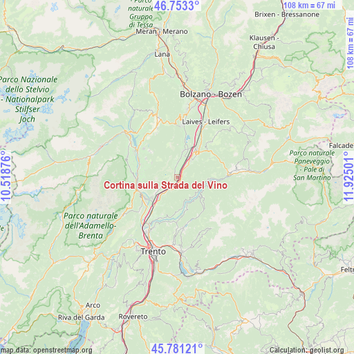
| Upper-left | 46.7533°, | 10.51876° |
| Center: | 46.26941°, | 11.22188° |
| Lower-right: | 45.78121°, | 11.92501° |
| Map W x H: | 108.1×108.1 km | = 67.2×67.2mi |
| max Lat: | 47.04031° ⇑3.4% North |
| Cortina sulla Strada del Vino: | 46.26941° |
| min Lat: | ⇓96.6% South 35.50142° |
| min Long | Cortina sulla S | max Long |
| 6.69888° | 11.22188° | 18.48682° |
| W 45.8%⇐ | ⇒54.2% E |
Elevation
Elevation of Cortina sulla Strada del Vino is 212 m = 696 ft, and this is 94.7 m = 311 ft below average elevation for this country.
| Max E: |
2085 m = 6841 ft | 53.6% |
| Avg. | 306.7 m = 1006 ft | |
| Cortina sulla Strada del Vino | 212 m = 696 ft | |
Min E: |
-4 m = -13 ft | 46.4% |
See also: Italy elevation on elevation.city.
Geographical zone
Cortina sulla Strada del Vino is located in North temperate zone (between Tropic of Cancer and the Arctic Circle). Distance of this North polar circle is 2256.5 km =1402.1 mi to North.| Distance of | km | miles | from Cortina sulla Strada del Vino |
|---|---|---|---|
| North Pole | 4862.4 | 3021.4 | to North |
| Arctic Circle | 2256.5 | 1402.1 | to North |
| Tropic Cancer | 2538.8 | 1577.5 | to South |
| Equator | 5144.7 | 3196.8 | to South |


Nearby cities:
15 places around Cortina sulla Strada del Vino: (largest is in red/bold)
• Capriana
9 km =5.6 mi,  94°
94°
• Cortaccia sulla Strada del Vino
5 km =3.1 mi,  1°
1°
• Egna
6.7 km =4.2 mi,  36°
36°
• Grauno
7.3 km =4.5 mi,  126°
126°
• Grumes
7.7 km =4.8 mi, 134°
• Laghetti
1.5 km =0.9 mi,  67°
67°
• Magrè sulla Strada del Vino
2.2 km =1.4 mi,  337°
337°
• Montagna
9.1 km =5.7 mi, 41°
• Roverè della Luna
4.4 km =2.7 mi,  240°
240°
• Salorno
3.3 km =2.1 mi,  193°
193°
• Segonzano
9.3 km =5.8 mi,  161°
161°
• Sover
9 km =5.6 mi, 126°
• Termeno
8.2 km =5.1 mi,  11°
11°
• Valda
7.7 km =4.8 mi,  154°
154°
• Vervò
9 km =5.6 mi,  299°
299°
Sources, notices
• [Note1] Compared only with cities in Italy existing in our database
• [Src1] Map data: © OpenStreetMap contributors (CC-BY-SA)
• [Src2] Other city data from geonames.org with taken over terms of usage.
• [Src3] Geographical zone / Annual Mean Temperature by Robert A. Rohde @ Wikipedia
