Laghi geodata
Laghi (Veneto) is a seat of a third-order administrative division; located in Italy in Europe/Rome (GMT+2) time zone. With population of 50 people, there are 11602 cities with bigger population in this country. Compared to other cities in Italy, 86.9% of cities are located further ↓South; 53.5% of cities are located further →East and 82.6% of cities have lower elevation than Laghi. Note1


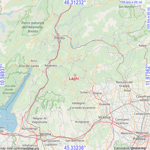
Laghi GPS coordinates[2]
45° 49' 28.2" North, 11° 16' 20.964" East
| Map corner | latitude | longitude |
|---|---|---|
| Upper-left | 46.31232°, | 10.56937° |
| Center: | 45.8245°, | 11.27249° |
| Lower-right: | 45.33236°, | 11.97562° |
| Map W x H: | 109×109 km | = 67.7×67.7mi |
| max Lat: | 47.04031° ⇑13.1% North |
| Laghi: | 45.8245° |
| min Lat: | ⇓86.9% South 35.50142° |
| min Long | Laghi | max Long |
| 6.69888° | 11.27249° | 18.48682° |
| W 46.5%⇐ | ⇒53.5% E |
Elevation
Elevation of Laghi is 564 m = 1850 ft, and this is 257.3 m = 844 ft above average elevation for this country.
| Max E: |
2085 m = 6841 ft | 17.4% |
| Laghi | 564 m 1850 ft | |
| Avg. | 306.7 m = 1006 ft | |
Min E: |
-4 m = -13 ft | 82.6% |
See also: Italy elevation on elevation.city.
Geographical zone
Laghi is located in North temperate zone (between Tropic of Cancer and the Arctic Circle). Distance of this North polar circle is 2306 km =1432.9 mi to North.| Distance of | km | miles | from Laghi |
|---|---|---|---|
| North Pole | 4911.9 | 3052.1 | to North |
| Arctic Circle | 2306 | 1432.9 | to North |
| Tropic Cancer | 2489.3 | 1546.8 | to South |
| Equator | 5095.2 | 3166 | to South |


Nearby cities:
15 places around Laghi: (largest is in red/bold)
• Arsiero
6.8 km =4.2 mi,  109°
109°
• Lastebasse
10.1 km =6.3 mi,  0°
0°
• Longhi
9.7 km =6 mi,  18°
18°
• Luserna
11.6 km =7.2 mi, 19°
• Pedemonte
9.7 km =6 mi, 16°
• Piazza
10.6 km =6.6 mi,  303°
303°
• Posina
3.8 km =2.4 mi,  191°
191°
• Rotzo
10.4 km =6.5 mi,  66°
66°
• San Pietro Valdastico
9.8 km =6.1 mi,  44°
44°
• Seghe
8.2 km =5.1 mi, 110°
• Terragnolo
10.9 km =6.8 mi, 303°
• Tonezza del Cimone
6.9 km =4.3 mi,  56°
56°
• Valli del Pasubio
9.4 km =5.8 mi,  184°
184°
• Velo
8.3 km =5.2 mi,  117°
117°
• Velo d'Astico
8.4 km =5.2 mi, 118°
Sources, notices
• [Note1] Compared only with cities in Italy existing in our database
• [Src1] Map data: © OpenStreetMap contributors (CC-BY-SA)
• [Src2] Other city data from geonames.org with taken over terms of usage.
• [Src3] Geographical zone / Annual Mean Temperature by Robert A. Rohde @ Wikipedia
