Broccostella geodata
Broccostella (Latium) is a seat of a third-order administrative division; located in Italy in Europe/Rome (GMT+2) time zone. With population of 1,507 people, there are 5099 cities with bigger population in this country. Compared to other cities in Italy, 72.9% of cities are located further ↑North; 75% of cities are located further ←West and 60.2% of cities have lower elevation than Broccostella. Note1


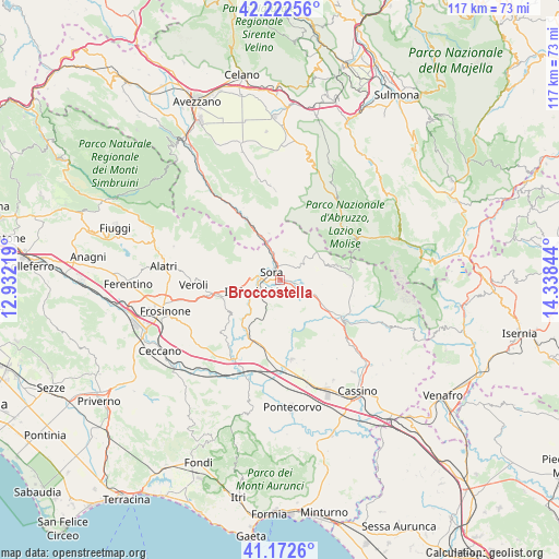
Broccostella GPS coordinates[2]
41° 41' 58.992" North, 13° 38' 7.116" East
| Map corner | latitude | longitude |
|---|---|---|
| Upper-left | 42.22256°, | 12.93219° |
| Center: | 41.69972°, | 13.63531° |
| Lower-right: | 41.1726°, | 14.33844° |
| Map W x H: | 116.7×116.7 km | = 72.5×72.5mi |
| max Lat: | 47.04031° ⇑72.9% North |
| Broccostella: | 41.69972° |
| min Lat: | ⇓27.1% South 35.50142° |
| min Long | Broccostella | max Long |
| 6.69888° | 13.63531° | 18.48682° |
| W 75%⇐ | ⇒25% E |
Elevation
Elevation of Broccostella is 300 m = 984 ft, and this is 6.7 m = 22 ft below average elevation for this country.
| Max E: |
2085 m = 6841 ft | 39.8% |
| Avg. | 306.7 m = 1006 ft | |
| Broccostella | 300 m = 984 ft | |
Min E: |
-4 m = -13 ft | 60.2% |
See also: Italy elevation on elevation.city.
Geographical zone
Broccostella is located in North temperate zone (between Tropic of Cancer and the Arctic Circle). Distance of this Northern Tropic circle is 2030.7 km =1261.8 mi to South.| Distance of | km | miles | from Broccostella |
|---|---|---|---|
| North Pole | 5370.5 | 3337.1 | to North |
| Arctic Circle | 2764.6 | 1717.8 | to North |
| Tropic Cancer | 2030.7 | 1261.8 | to South |
| Equator | 4636.6 | 2881 | to South |


Nearby cities:
15 places around Broccostella: (largest is in red/bold)
• Alvito
9.4 km =5.8 mi,  96°
96°
• Anitrella-Chiaiamari
9.9 km =6.2 mi,  226°
226°
• Arpino
6.2 km =3.9 mi,  198°
198°
• Campoli Appennino
5.6 km =3.5 mi,  45°
45°
• Carnello
2.8 km =1.7 mi, 227°
• Casalvieri
9.8 km =6.1 mi,  138°
138°
• Castelliri
8.3 km =5.2 mi,  252°
252°
• Fontechiari
4.8 km =3 mi, 137°
• Isola del Liri
3.5 km =2.2 mi, 245°
• Pescosolido
5.7 km =3.5 mi,  18°
18°
• Porrino
10.7 km =6.6 mi, 254°
• Posta Fibreno
3.8 km =2.4 mi, 103°
• Ridotti
10 km =6.2 mi,  346°
346°
• Sora
2.7 km =1.7 mi,  318°
318°
• Vicalvi
6.5 km =4 mi,  111°
111°
Sources, notices
• [Note1] Compared only with cities in Italy existing in our database
• [Src1] Map data: © OpenStreetMap contributors (CC-BY-SA)
• [Src2] Other city data from geonames.org with taken over terms of usage.
• [Src3] Geographical zone / Annual Mean Temperature by Robert A. Rohde @ Wikipedia
