Marcignago geodata
Marcignago (Lombardy) is a seat of a third-order administrative division; located in Italy in Europe/Rome (GMT+2) time zone. With population of 1,895 people, there are 4325 cities with bigger population in this country. Compared to other cities in Italy, 66.3% of cities are located further ↓South; 80% of cities are located further →East and 71.6% of cities have higher elevation than Marcignago. Note1


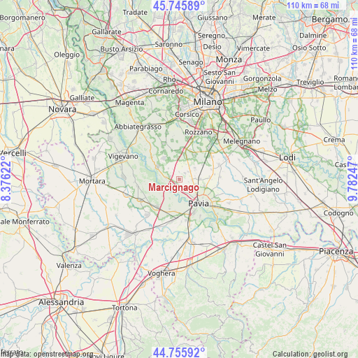
Marcignago GPS coordinates[2]
45° 15' 11.016" North, 9° 4' 45.66" East
| Map corner | latitude | longitude |
|---|---|---|
| Upper-left | 45.74589°, | 8.37622° |
| Center: | 45.25306°, | 9.07935° |
| Lower-right: | 44.75592°, | 9.78247° |
| Map W x H: | 110.1×110.1 km | = 68.4×68.4mi |
| max Lat: | 47.04031° ⇑33.7% North |
| Marcignago: | 45.25306° |
| min Lat: | ⇓66.3% South 35.50142° |
| min Long | Marcignago | max Long |
| 6.69888° | 9.07935° | 18.48682° |
| W 20%⇐ | ⇒80% E |
Elevation
Elevation of Marcignago is 89 m = 292 ft, and this is 217.7 m = 714 ft below average elevation for this country.
| Max E: |
2085 m = 6841 ft | 71.6% |
| Avg. | 306.7 m = 1006 ft | |
| Marcignago | 89 m = 292 ft | |
Min E: |
-4 m = -13 ft | 28.4% |
See also: Italy elevation on elevation.city.
Geographical zone
Marcignago is located in North temperate zone (between Tropic of Cancer and the Arctic Circle). Distance of this North polar circle is 2369.5 km =1472.3 mi to North.| Distance of | km | miles | from Marcignago |
|---|---|---|---|
| North Pole | 4975.4 | 3091.6 | to North |
| Arctic Circle | 2369.5 | 1472.3 | to North |
| Tropic Cancer | 2425.7 | 1507.3 | to South |
| Equator | 5031.7 | 3126.6 | to South |


Nearby cities:
15 places around Marcignago: (largest is in red/bold)
• Battuda
2.4 km =1.5 mi,  357°
357°
• Bereguardo
4.1 km =2.5 mi,  276°
276°
• Borgarello
5 km =3.1 mi,  106°
106°
• Cascine Calderari
4.4 km =2.7 mi,  123°
123°
• Casottole
2.9 km =1.8 mi,  197°
197°
• Certosa di Pavia
4.2 km =2.6 mi,  88°
88°
• Giovenzano
3.6 km =2.2 mi,  52°
52°
• Giussago
5.9 km =3.7 mi, 53°
• Rognano
4 km =2.5 mi,  12°
12°
• Torre d'Isola
3.9 km =2.4 mi,  183°
183°
• Torre del Mangano
4 km =2.5 mi, 91°
• Torriano
3.3 km =2.1 mi,  73°
73°
• Trivolzio
2.9 km =1.8 mi, 281°
• Trovo
4.8 km =3 mi,  314°
314°
• Vellezzo Bellini
2.5 km =1.6 mi,  42°
42°
Sources, notices
• [Note1] Compared only with cities in Italy existing in our database
• [Src1] Map data: © OpenStreetMap contributors (CC-BY-SA)
• [Src2] Other city data from geonames.org with taken over terms of usage.
• [Src3] Geographical zone / Annual Mean Temperature by Robert A. Rohde @ Wikipedia
