Montecreto geodata
Montecreto (Emilia-Romagna) is a seat of a third-order administrative division; located in Italy in Europe/Rome (GMT+2) time zone. With population of 339 people, there are 10516 cities with bigger population in this country. Compared to other cities in Italy, 52.3% of cities are located further ↑North; 60.8% of cities are located further →East and 95.4% of cities have lower elevation than Montecreto. Note1
Administrative division(s):
- Level 1: Emilia-Romagna
- Level 2: Provincia di Modena
- Level 3: Montecreto


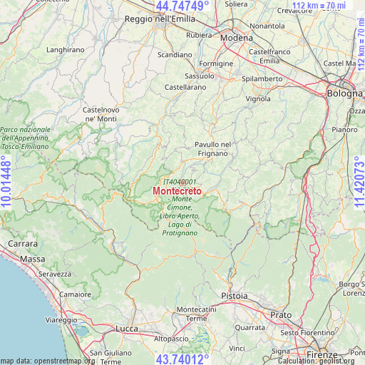
Montecreto GPS coordinates[2]
44° 14' 45.456" North, 10° 43' 3.36" East
| Map corner | latitude | longitude |
|---|---|---|
| Upper-left | 44.74749°, | 10.01448° |
| Center: | 44.24596°, | 10.7176° |
| Lower-right: | 43.74012°, | 11.42073° |
| Map W x H: | 112×112 km | = 69.6×69.6mi |
| max Lat: | 47.04031° ⇑52.3% North |
| Montecreto: | 44.24596° |
| min Lat: | ⇓47.7% South 35.50142° |
| min Long | Montecreto | max Long |
| 6.69888° | 10.7176° | 18.48682° |
| W 39.2%⇐ | ⇒60.8% E |
Elevation
Elevation of Montecreto is 894 m = 2933 ft, and this is 587.3 m = 1927 ft above average elevation for this country.
| Max E: |
2085 m = 6841 ft | 4.6% |
| Montecreto | 894 m 2933 ft | |
| Avg. | 306.7 m = 1006 ft | |
Min E: |
-4 m = -13 ft | 95.4% |
See also: Italy elevation on elevation.city.
Geographical zone
Montecreto is located in North temperate zone (between Tropic of Cancer and the Arctic Circle). Distance of this Northern Tropic circle is 2313.8 km =1437.7 mi to South.| Distance of | km | miles | from Montecreto |
|---|---|---|---|
| North Pole | 5087.4 | 3161.2 | to North |
| Arctic Circle | 2481.5 | 1541.9 | to North |
| Tropic Cancer | 2313.8 | 1437.7 | to South |
| Equator | 4919.7 | 3057 | to South |


Nearby cities:
15 places around Montecreto: (largest is in red/bold)
• Abetone
11.9 km =7.4 mi,  200°
200°
• Fanano
7.3 km =4.5 mi,  120°
120°
• Fiumalbo-Dogana
9.3 km =5.8 mi,  217°
217°
• Frassinoro
12.8 km =8 mi,  294°
294°
• Lama
6.9 km =4.3 mi,  8°
8°
• Montefiorino
14.1 km =8.8 mi,  328°
328°
• Palagano
10.1 km =6.3 mi, 326°
• Pavullo nel Frignano
13.5 km =8.4 mi,  43°
43°
• Pievepelago
9.3 km =5.8 mi,  240°
240°
• Polinago
11 km =6.8 mi,  3°
3°
• Querciagrossa
11.4 km =7.1 mi,  50°
50°
• Riolunato
5.4 km =3.4 mi,  252°
252°
• Sant'Antonio
16.3 km =10.1 mi, 35°
• Sestola
4.8 km =3 mi,  111°
111°
• Vidiciatico
15.2 km =9.4 mi, 123°
Sources, notices
• [Note1] Compared only with cities in Italy existing in our database
• [Src1] Map data: © OpenStreetMap contributors (CC-BY-SA)
• [Src2] Other city data from geonames.org with taken over terms of usage.
• [Src3] Geographical zone / Annual Mean Temperature by Robert A. Rohde @ Wikipedia
