Pavullo nel Frignano geodata
Pavullo nel Frignano (Emilia-Romagna) is a seat of a third-order administrative division; located in Italy in Europe/Rome (GMT+2) time zone. With population of 9,063 people, there are 1043 cities with bigger population in this country. Compared to other cities in Italy, 51.5% of cities are located further ↑North; 59.3% of cities are located further →East and 89% of cities have lower elevation than Pavullo nel Frignano. Note1
Administrative division(s):
- Level 1: Emilia-Romagna
- Level 2: Provincia di Modena
- Level 3: Pavullo nel Frignano
Current local time in Pavullo nel Frignano:
11:44 PM, WednesdayDifference from your time zone: hours


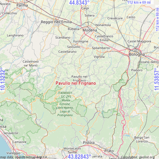
Pavullo nel Frignano GPS coordinates[2]
44° 20' 0.672" North, 10° 50' 7.584" East
| Map corner | latitude | longitude |
|---|---|---|
| Upper-left | 44.8343°, | 10.13232° |
| Center: | 44.33352°, | 10.83544° |
| Lower-right: | 43.82843°, | 11.53857° |
| Map W x H: | 111.8×111.8 km | = 69.5×69.5mi |
| max Lat: | 47.04031° ⇑51.5% North |
| Pavullo nel Frignano: | 44.33352° |
| min Lat: | ⇓48.5% South 35.50142° |
| min Long | Pavullo nel Fri | max Long |
| 6.69888° | 10.83544° | 18.48682° |
| W 40.7%⇐ | ⇒59.3% E |
Elevation
Elevation of Pavullo nel Frignano is 693 m = 2274 ft, and this is 386.3 m = 1267 ft above average elevation for this country.
| Max E: |
2085 m = 6841 ft | 11% |
| Pavullo nel Frignano | 693 m 2274 ft | |
| Avg. | 306.7 m = 1006 ft | |
Min E: |
-4 m = -13 ft | 89% |
See also: Italy elevation on elevation.city.
Geographical zone
Pavullo nel Frignano is located in North temperate zone (between Tropic of Cancer and the Arctic Circle). Distance of this Northern Tropic circle is 2323.5 km =1443.8 mi to South.| Distance of | km | miles | from Pavullo nel Frignano |
|---|---|---|---|
| North Pole | 5077.6 | 3155.1 | to North |
| Arctic Circle | 2471.7 | 1535.8 | to North |
| Tropic Cancer | 2323.5 | 1443.8 | to South |
| Equator | 4929.4 | 3063 | to South |


Nearby cities:
15 places around Pavullo nel Frignano: (largest is in red/bold)
• Castel d'Aiano
14.6 km =9.1 mi,  115°
115°
• Fanano
13.8 km =8.6 mi,  192°
192°
• Guiglia
14.2 km =8.8 mi,  44°
44°
• Lama
8.8 km =5.5 mi,  250°
250°
• Montecreto
13.5 km =8.4 mi,  223°
223°
• Monteombraro
14.2 km =8.8 mi,  67°
67°
• Montese
11.3 km =7 mi,  128°
128°
• Palagano
15.1 km =9.4 mi,  264°
264°
• Polinago
8.8 km =5.5 mi,  278°
278°
• Querciagrossa
2.5 km =1.6 mi, 193°
• Rocca Malatina
12 km =7.5 mi,  59°
59°
• Sant'Antonio
3.6 km =2.2 mi,  1°
1°
• Serramazzoni
11 km =6.8 mi,  341°
341°
• Sestola
12.5 km =7.8 mi,  203°
203°
• Zocca
12.6 km =7.8 mi,  83°
83°
Sources, notices
• [Note1] Compared only with cities in Italy existing in our database
• [Src1] Map data: © OpenStreetMap contributors (CC-BY-SA)
• [Src2] Other city data from geonames.org with taken over terms of usage.
• [Src3] Geographical zone / Annual Mean Temperature by Robert A. Rohde @ Wikipedia
