Dernice geodata
Dernice (Piedmont) is a seat of a third-order administrative division; located in Italy in Europe/Rome (GMT+2) time zone. With population of 66 people, there are 11548 cities with bigger population in this country. Compared to other cities in Italy, 55.6% of cities are located further ↓South; 80.5% of cities are located further →East and 83.7% of cities have lower elevation than Dernice. Note1


Dernice GPS coordinates[2]
44° 45' 59.76" North, 9° 3' 0.036" East
| Map corner | latitude | longitude |
|---|---|---|
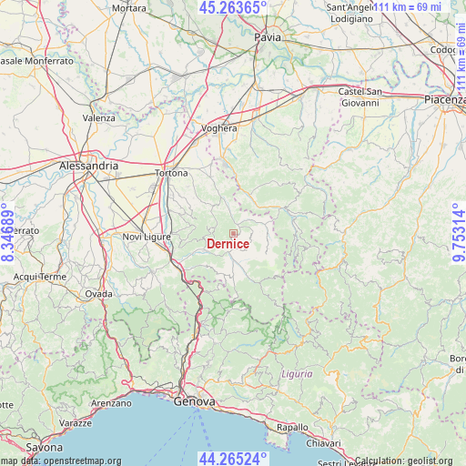
| Upper-left | 45.26365°, | 8.34689° |
| Center: | 44.7666°, | 9.05001° |
| Lower-right: | 44.26524°, | 9.75314° |
| Map W x H: | 111×111 km | = 69×69mi |
| max Lat: | 47.04031° ⇑44.4% North |
| Dernice: | 44.7666° |
| min Lat: | ⇓55.6% South 35.50142° |
| min Long | Dernice | max Long |
| 6.69888° | 9.05001° | 18.48682° |
| W 19.5%⇐ | ⇒80.5% E |
Elevation
Elevation of Dernice is 586 m = 1923 ft, and this is 279.3 m = 916 ft above average elevation for this country.
| Max E: |
2085 m = 6841 ft | 16.3% |
| Dernice | 586 m 1923 ft | |
| Avg. | 306.7 m = 1006 ft | |
Min E: |
-4 m = -13 ft | 83.7% |
See also: Italy elevation on elevation.city.
Geographical zone
Dernice is located in North temperate zone (between Tropic of Cancer and the Arctic Circle). Distance of this Northern Tropic circle is 2371.7 km =1473.7 mi to South.| Distance of | km | miles | from Dernice |
|---|---|---|---|
| North Pole | 5029.5 | 3125.2 | to North |
| Arctic Circle | 2423.6 | 1506 | to North |
| Tropic Cancer | 2371.7 | 1473.7 | to South |
| Equator | 4977.6 | 3092.9 | to South |


Nearby cities:
15 places around Dernice: (largest is in red/bold)
• Albera Ligure
7.4 km =4.6 mi,  169°
169°
• Avolasca
7.8 km =4.8 mi,  301°
301°
• Bagnaria
8.8 km =5.5 mi,  40°
40°
• Borghetto di Borbera
9.4 km =5.8 mi,  243°
243°
• Brignano
5.4 km =3.4 mi,  351°
351°
• Cantalupo Ligure
5.4 km =3.4 mi,  183°
183°
• Casasco
7.6 km =4.7 mi,  332°
332°
• Garadassi
8.3 km =5.2 mi,  99°
99°
• Garbagna
4.4 km =2.7 mi,  290°
290°
• Gremiasco
5.6 km =3.5 mi,  53°
53°
• Momperone
8.1 km =5 mi, 351°
• Montacuto
4.3 km =2.7 mi,  90°
90°
• Rocchetta Ligure
6.7 km =4.2 mi, 179°
• San Sebastiano Curone
2.5 km =1.6 mi,  27°
27°
• Torreratti-Persi
7.5 km =4.7 mi, 240°
Sources, notices
• [Note1] Compared only with cities in Italy existing in our database
• [Src1] Map data: © OpenStreetMap contributors (CC-BY-SA)
• [Src2] Other city data from geonames.org with taken over terms of usage.
• [Src3] Geographical zone / Annual Mean Temperature by Robert A. Rohde @ Wikipedia
