Cornovecchio geodata
Cornovecchio (Lombardy) is a seat of a third-order administrative division; located in Italy in Europe/Rome (GMT+2) time zone. With population of 163 people, there are 11239 cities with bigger population in this country. Compared to other cities in Italy, 63.4% of cities are located further ↓South; 69.8% of cities are located further →East and 79.3% of cities have higher elevation than Cornovecchio. Note1


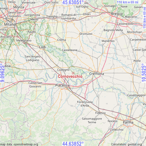
Cornovecchio GPS coordinates[2]
45° 8' 12.012" North, 9° 47' 57.732" East
| Map corner | latitude | longitude |
|---|---|---|
| Upper-left | 45.63051°, | 9.09625° |
| Center: | 45.13667°, | 9.79937° |
| Lower-right: | 44.63852°, | 10.5025° |
| Map W x H: | 110.3×110.3 km | = 68.5×68.5mi |
| max Lat: | 47.04031° ⇑36.6% North |
| Cornovecchio: | 45.13667° |
| min Lat: | ⇓63.4% South 35.50142° |
| min Long | Cornovecchio | max Long |
| 6.69888° | 9.79937° | 18.48682° |
| W 30.2%⇐ | ⇒69.8% E |
Elevation
Elevation of Cornovecchio is 53 m = 174 ft, and this is 253.7 m = 832 ft below average elevation for this country.
| Max E: |
2085 m = 6841 ft | 79.3% |
| Avg. | 306.7 m = 1006 ft | |
| Cornovecchio | 53 m = 174 ft | |
Min E: |
-4 m = -13 ft | 20.7% |
See also: Italy elevation on elevation.city.
Geographical zone
Cornovecchio is located in North temperate zone (between Tropic of Cancer and the Arctic Circle). Distance of this North polar circle is 2382.4 km =1480.4 mi to North.| Distance of | km | miles | from Cornovecchio |
|---|---|---|---|
| North Pole | 4988.3 | 3099.6 | to North |
| Arctic Circle | 2382.4 | 1480.4 | to North |
| Tropic Cancer | 2412.8 | 1499.2 | to South |
| Equator | 5018.7 | 3118.5 | to South |


Nearby cities:
15 places around Cornovecchio: (largest is in red/bold)
• Acquanegra Cremonese
8 km =5 mi,  63°
63°
• Caselle Landi
3.8 km =2.4 mi,  184°
184°
• Castelnuovo Bocca d'Adda
5.8 km =3.6 mi,  119°
119°
• Cavacurta
7.4 km =4.6 mi,  322°
322°
• Corno Giovine
3.3 km =2.1 mi,  265°
265°
• Crotta d'Adda
5.1 km =3.2 mi, 61°
• Maccastorna
4.5 km =2.8 mi,  75°
75°
• Maleo
4.4 km =2.7 mi, 318°
• Meleti
3.4 km =2.1 mi, 123°
• Mortizza
7.5 km =4.7 mi,  207°
207°
• Pizzighettone
5.7 km =3.5 mi,  350°
350°
• Regona
7.8 km =4.8 mi,  11°
11°
• Roggione
5.3 km =3.3 mi, 6°
• San Fiorano
6.2 km =3.9 mi, 271°
• Santo Stefano Lodigiano
5.4 km =3.4 mi,  248°
248°
Sources, notices
• [Note1] Compared only with cities in Italy existing in our database
• [Src1] Map data: © OpenStreetMap contributors (CC-BY-SA)
• [Src2] Other city data from geonames.org with taken over terms of usage.
• [Src3] Geographical zone / Annual Mean Temperature by Robert A. Rohde @ Wikipedia
