Ceniga geodata
Ceniga (Trentino-Alto Adige) is a populated place; located in Italy in Europe/Rome (GMT+2) time zone. With population of 714 people, there are 8195 cities with bigger population in this country. Compared to other cities in Italy, 90.6% of cities are located further ↓South; 58.5% of cities are located further →East and 67.1% of cities have higher elevation than Ceniga. Note1
Administrative division(s):
- Level 1: Trentino-Alto Adige
- Level 2: Provincia autonoma di Trento
- Level 3: Dro


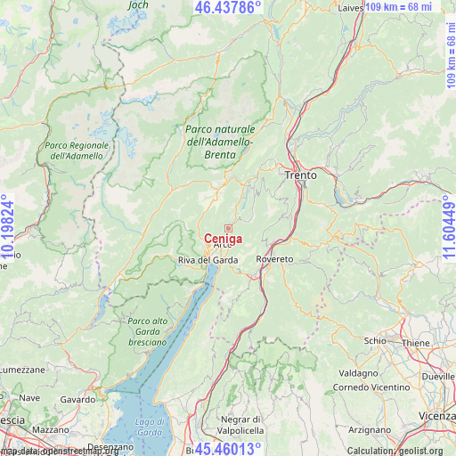
Ceniga GPS coordinates[2]
45° 57' 4.14" North, 10° 54' 4.896" East
| Map corner | latitude | longitude |
|---|---|---|
| Upper-left | 46.43786°, | 10.19824° |
| Center: | 45.95115°, | 10.90136° |
| Lower-right: | 45.46013°, | 11.60449° |
| Map W x H: | 108.7×108.7 km | = 67.5×67.5mi |
| max Lat: | 47.04031° ⇑9.4% North |
| Ceniga: | 45.95115° |
| min Lat: | ⇓90.6% South 35.50142° |
| min Long | Ceniga | max Long |
| 6.69888° | 10.90136° | 18.48682° |
| W 41.5%⇐ | ⇒58.5% E |
Elevation
Elevation of Ceniga is 115 m = 377 ft, and this is 191.7 m = 629 ft below average elevation for this country.
| Max E: |
2085 m = 6841 ft | 67.1% |
| Avg. | 306.7 m = 1006 ft | |
| Ceniga | 115 m = 377 ft | |
Min E: |
-4 m = -13 ft | 32.9% |
See also: Italy elevation on elevation.city.
Geographical zone
Ceniga is located in North temperate zone (between Tropic of Cancer and the Arctic Circle). Distance of this North polar circle is 2291.9 km =1424.1 mi to North.| Distance of | km | miles | from Ceniga |
|---|---|---|---|
| North Pole | 4897.8 | 3043.4 | to North |
| Arctic Circle | 2291.9 | 1424.1 | to North |
| Tropic Cancer | 2503.4 | 1555.5 | to South |
| Equator | 5109.3 | 3174.8 | to South |


Nearby cities:
15 places around Ceniga: (largest is in red/bold)
• Arco
3.9 km =2.4 mi,  196°
196°
• Bolognano-Vignole
4.4 km =2.7 mi,  176°
176°
• Castellano
8.7 km =5.4 mi,  110°
110°
• Cavedine
7.4 km =4.6 mi,  48°
48°
• Cologna-Gavazzo Nuova
6.3 km =3.9 mi,  227°
227°
• Drena
4 km =2.5 mi,  59°
59°
• Dro
1.4 km =0.9 mi,  36°
36°
• Fiavè
7.5 km =4.7 mi,  322°
322°
• Nago-Torbole
8.4 km =5.2 mi,  185°
185°
• Pietramurata
8.3 km =5.2 mi,  22°
22°
• Riva del Garda
8.6 km =5.3 mi,  212°
212°
• Ronzo-Chienis
7.8 km =4.8 mi,  151°
151°
• San Giorgio
6.2 km =3.9 mi, 208°
• Tenno
6.4 km =4 mi,  236°
236°
• Vigo
6.8 km =4.2 mi, 63°
Sources, notices
• [Note1] Compared only with cities in Italy existing in our database
• [Src1] Map data: © OpenStreetMap contributors (CC-BY-SA)
• [Src2] Other city data from geonames.org with taken over terms of usage.
• [Src3] Geographical zone / Annual Mean Temperature by Robert A. Rohde @ Wikipedia
