Bolognano-Vignole geodata
Bolognano-Vignole (Trentino-Alto Adige) is a populated place; located in Italy in Europe/Rome (GMT+2) time zone. With population of 2,752 people, there are 3266 cities with bigger population in this country. Compared to other cities in Italy, 89.6% of cities are located further ↓South; 58.5% of cities are located further →East and 63.1% of cities have higher elevation than Bolognano-Vignole. Note1
Administrative division(s):
- Level 1: Trentino-Alto Adige
- Level 2: Provincia autonoma di Trento
- Level 3: Arco


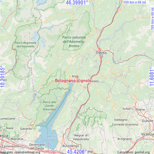
Bolognano-Vignole GPS coordinates[2]
45° 54' 43.056" North, 10° 54' 17.892" East
| Map corner | latitude | longitude |
|---|---|---|
| Upper-left | 46.39901°, | 10.20185° |
| Center: | 45.91196°, | 10.90497° |
| Lower-right: | 45.4206°, | 11.6081° |
| Map W x H: | 108.8×108.8 km | = 67.6×67.6mi |
| max Lat: | 47.04031° ⇑10.4% North |
| Bolognano-Vignole: | 45.91196° |
| min Lat: | ⇓89.6% South 35.50142° |
| min Long | Bolognano-Vigno | max Long |
| 6.69888° | 10.90497° | 18.48682° |
| W 41.5%⇐ | ⇒58.5% E |
Elevation
Elevation of Bolognano-Vignole is 140 m = 459 ft, and this is 166.7 m = 547 ft below average elevation for this country.
| Max E: |
2085 m = 6841 ft | 63.1% |
| Avg. | 306.7 m = 1006 ft | |
| Bolognano-Vignole | 140 m = 459 ft | |
Min E: |
-4 m = -13 ft | 36.9% |
See also: Italy elevation on elevation.city.
Geographical zone
Bolognano-Vignole is located in North temperate zone (between Tropic of Cancer and the Arctic Circle). Distance of this North polar circle is 2296.2 km =1426.8 mi to North.| Distance of | km | miles | from Bolognano-Vignole |
|---|---|---|---|
| North Pole | 4902.1 | 3046 | to North |
| Arctic Circle | 2296.2 | 1426.8 | to North |
| Tropic Cancer | 2499 | 1552.8 | to South |
| Equator | 5104.9 | 3172 | to South |


Nearby cities:
15 places around Bolognano-Vignole: (largest is in red/bold)
• Arco
1.6 km =1 mi,  294°
294°
• Castellano
8 km =5 mi,  80°
80°
• Ceniga
4.4 km =2.7 mi,  356°
356°
• Cologna-Gavazzo Nuova
4.9 km =3 mi,  271°
271°
• Drena
7.1 km =4.4 mi,  26°
26°
• Dro
5.5 km =3.4 mi,  5°
5°
• Isera
8.5 km =5.3 mi,  108°
108°
• Mori
8.9 km =5.5 mi,  138°
138°
• Nago-Torbole
4.1 km =2.5 mi,  195°
195°
• Pedersano
9 km =5.6 mi, 84°
• Riva del Garda
5.7 km =3.5 mi,  239°
239°
• Ronzo-Chienis
4.3 km =2.7 mi,  125°
125°
• San Giorgio
3.4 km =2.1 mi,  250°
250°
• Tenno
5.7 km =3.5 mi,  278°
278°
• Torbole sul Garda
5.2 km =3.2 mi,  205°
205°
Sources, notices
• [Note1] Compared only with cities in Italy existing in our database
• [Src1] Map data: © OpenStreetMap contributors (CC-BY-SA)
• [Src2] Other city data from geonames.org with taken over terms of usage.
• [Src3] Geographical zone / Annual Mean Temperature by Robert A. Rohde @ Wikipedia
