Colombella geodata
Colombella (Umbria) is a populated place; located in Italy in Europe/Rome (GMT+2) time zone. With population of 3,199 people, there are 2897 cities with bigger population in this country. Compared to other cities in Italy, 62.2% of cities are located further ↑North; 62.2% of cities are located further ←West and 56.2% of cities have lower elevation than Colombella. Note1


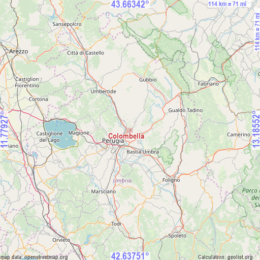
Colombella GPS coordinates[2]
43° 9' 9.432" North, 12° 28' 56.604" East
| Map corner | latitude | longitude |
|---|---|---|
| Upper-left | 43.66342°, | 11.77927° |
| Center: | 43.15262°, | 12.48239° |
| Lower-right: | 42.63751°, | 13.18552° |
| Map W x H: | 114.1×114.1 km | = 70.9×70.9mi |
| max Lat: | 47.04031° ⇑62.2% North |
| Colombella: | 43.15262° |
| min Lat: | ⇓37.8% South 35.50142° |
| min Long | Colombella | max Long |
| 6.69888° | 12.48239° | 18.48682° |
| W 62.2%⇐ | ⇒37.8% E |
Elevation
Elevation of Colombella is 273 m = 896 ft, and this is 33.7 m = 111 ft below average elevation for this country.
| Max E: |
2085 m = 6841 ft | 43.8% |
| Avg. | 306.7 m = 1006 ft | |
| Colombella | 273 m = 896 ft | |
Min E: |
-4 m = -13 ft | 56.2% |
See also: Italy elevation on elevation.city.
Geographical zone
Colombella is located in North temperate zone (between Tropic of Cancer and the Arctic Circle). Distance of this Northern Tropic circle is 2192.2 km =1362.2 mi to South.| Distance of | km | miles | from Colombella |
|---|---|---|---|
| North Pole | 5208.9 | 3236.7 | to North |
| Arctic Circle | 2603.1 | 1617.5 | to North |
| Tropic Cancer | 2192.2 | 1362.2 | to South |
| Equator | 4798.1 | 2981.4 | to South |


Nearby cities:
15 places around Colombella: (largest is in red/bold)
• Casa del Diavolo
4.7 km =2.9 mi,  325°
325°
• Fratticiola Selvatica
7 km =4.3 mi,  53°
53°
• Ospedalicchio
8.4 km =5.2 mi,  169°
169°
• Osteria di Ramazzano
2.6 km =1.6 mi,  321°
321°
• Palazzo
9.1 km =5.7 mi,  132°
132°
• Perugia
8.8 km =5.5 mi,  239°
239°
• Petrignano
6.9 km =4.3 mi,  143°
143°
• Piccione
3.8 km =2.4 mi,  35°
35°
• Ponte Felcino
3.7 km =2.3 mi,  227°
227°
• Ponte Pattoli
5.2 km =3.2 mi,  302°
302°
• Resina I
7.2 km =4.5 mi, 320°
• Sant'Egidio
5.6 km =3.5 mi, 173°
• Torchiagina
5.6 km =3.5 mi, 130°
• Via Lippia
7.4 km =4.6 mi,  180°
180°
• bishopric of Perugia
8.8 km =5.5 mi, 239°
Sources, notices
• [Note1] Compared only with cities in Italy existing in our database
• [Src1] Map data: © OpenStreetMap contributors (CC-BY-SA)
• [Src2] Other city data from geonames.org with taken over terms of usage.
• [Src3] Geographical zone / Annual Mean Temperature by Robert A. Rohde @ Wikipedia
