Resina I geodata
Resina I (Umbria) is a populated place; located in Italy in Europe/Rome (GMT+2) time zone. With population of 538 people, there are 9563 cities with bigger population in this country. Compared to other cities in Italy, 61.8% of cities are located further ↑North; 61.6% of cities are located further ←West and 51.4% of cities have higher elevation than Resina I. Note1


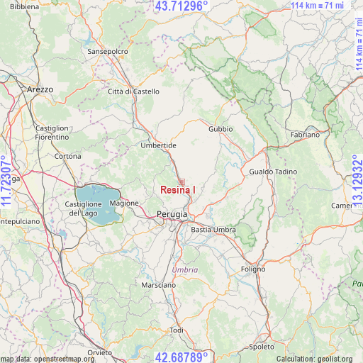
Resina I GPS coordinates[2]
43° 12' 9.288" North, 12° 25' 34.284" East
| Map corner | latitude | longitude |
|---|---|---|
| Upper-left | 43.71296°, | 11.72307° |
| Center: | 43.20258°, | 12.42619° |
| Lower-right: | 42.68789°, | 13.12932° |
| Map W x H: | 114×114 km | = 70.8×70.8mi |
| max Lat: | 47.04031° ⇑61.8% North |
| Resina I: | 43.20258° |
| min Lat: | ⇓38.2% South 35.50142° |
| min Long | Resina I | max Long |
| 6.69888° | 12.42619° | 18.48682° |
| W 61.6%⇐ | ⇒38.4% E |
Elevation
Elevation of Resina I is 225 m = 738 ft, and this is 81.7 m = 268 ft below average elevation for this country.
| Max E: |
2085 m = 6841 ft | 51.4% |
| Avg. | 306.7 m = 1006 ft | |
| Resina I | 225 m = 738 ft | |
Min E: |
-4 m = -13 ft | 48.6% |
See also: Italy elevation on elevation.city.
Geographical zone
Resina I is located in North temperate zone (between Tropic of Cancer and the Arctic Circle). Distance of this Northern Tropic circle is 2197.8 km =1365.6 mi to South.| Distance of | km | miles | from Resina I |
|---|---|---|---|
| North Pole | 5203.4 | 3233.2 | to North |
| Arctic Circle | 2597.5 | 1614 | to North |
| Tropic Cancer | 2197.8 | 1365.6 | to South |
| Equator | 4803.7 | 2984.9 | to South |


Nearby cities:
15 places around Resina I: (largest is in red/bold)
• Casa del Diavolo
2.5 km =1.6 mi,  131°
131°
• Colombella
7.2 km =4.5 mi,  140°
140°
• Comparati
9.5 km =5.9 mi,  239°
239°
• Fratticiola Selvatica
10.2 km =6.3 mi,  97°
97°
• La Cinella
6.6 km =4.1 mi,  339°
339°
• Oliveto
9.9 km =6.2 mi,  207°
207°
• Oscano
8.7 km =5.4 mi, 235°
• Osteria di Ramazzano
4.5 km =2.8 mi, 140°
• Perugia
10.5 km =6.5 mi,  196°
196°
• Piccione
7.2 km =4.5 mi,  109°
109°
• Pierantonio
7.5 km =4.7 mi, 336°
• Ponte Felcino
8.2 km =5.1 mi,  166°
166°
• Ponte Pattoli
2.7 km =1.7 mi,  176°
176°
• Stazione di Parlesca e Solfagnano
2.1 km =1.3 mi,  330°
330°
• bishopric of Perugia
10.5 km =6.5 mi, 196°
Sources, notices
• [Note1] Compared only with cities in Italy existing in our database
• [Src1] Map data: © OpenStreetMap contributors (CC-BY-SA)
• [Src2] Other city data from geonames.org with taken over terms of usage.
• [Src3] Geographical zone / Annual Mean Temperature by Robert A. Rohde @ Wikipedia
