Variney Chez Roncoz geodata
Variney Chez Roncoz (Aosta Valley) is a populated place; located in Italy in Europe/Rome (GMT+2) time zone. With population of 541 people, there are 9544 cities with bigger population in this country. Compared to other cities in Italy, 84.4% of cities are located further ↓South; 98.9% of cities are located further →East and 92.1% of cities have lower elevation than Variney Chez Roncoz. Note1


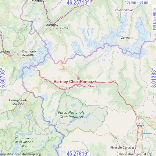
Variney Chez Roncoz GPS coordinates[2]
45° 46' 7.752" North, 7° 18' 37.836" East
| Map corner | latitude | longitude |
|---|---|---|
| Upper-left | 46.25713°, | 6.60738° |
| Center: | 45.76882°, | 7.31051° |
| Lower-right: | 45.27619°, | 8.01363° |
| Map W x H: | 109.1×109.1 km | = 67.8×67.8mi |
| max Lat: | 47.04031° ⇑15.6% North |
| Variney Chez Roncoz: | 45.76882° |
| min Lat: | ⇓84.4% South 35.50142° |
| min Long | Variney Chez Ro | max Long |
| 6.69888° | 7.31051° | 18.48682° |
| W 1.1%⇐ | ⇒98.9% E |
Elevation
Elevation of Variney Chez Roncoz is 775 m = 2543 ft, and this is 468.3 m = 1536 ft above average elevation for this country.
| Max E: |
2085 m = 6841 ft | 7.9% |
| Variney Chez Roncoz | 775 m 2543 ft | |
| Avg. | 306.7 m = 1006 ft | |
Min E: |
-4 m = -13 ft | 92.1% |
See also: Italy elevation on elevation.city.
Geographical zone
Variney Chez Roncoz is located in North temperate zone (between Tropic of Cancer and the Arctic Circle). Distance of this North polar circle is 2312.2 km =1436.7 mi to North.| Distance of | km | miles | from Variney Chez Roncoz |
|---|---|---|---|
| North Pole | 4918 | 3055.9 | to North |
| Arctic Circle | 2312.2 | 1436.7 | to North |
| Tropic Cancer | 2483.1 | 1542.9 | to South |
| Equator | 5089 | 3162.2 | to South |


Nearby cities:
15 places around Variney Chez Roncoz: (largest is in red/bold)
• Allein
5.2 km =3.2 mi,  325°
325°
• Aosta
3.5 km =2.2 mi,  171°
171°
• Arpuilles
1.7 km =1.1 mi,  191°
191°
• Charvensod
5.5 km =3.4 mi, 168°
• Chef-Lieu
3.9 km =2.4 mi,  120°
120°
• Gignod
1.7 km =1.1 mi,  318°
318°
• Gressan
5.5 km =3.4 mi, 194°
• La Cretaz-Roisan
1.7 km =1.1 mi,  6°
6°
• Montan-Angelin-Arensod
5.2 km =3.2 mi,  210°
210°
• Plan Felinaz-Felinaz
5 km =3.1 mi,  158°
158°
• Pollein
5.6 km =3.5 mi,  145°
145°
• Pont Suaz-Ampaillant
4.7 km =2.9 mi, 172°
• Porossan
1.9 km =1.2 mi,  138°
138°
• Saint-Christophe
3.3 km =2.1 mi, 119°
• Ville Sur Sarre
5.6 km =3.5 mi,  225°
225°
Sources, notices
• [Note1] Compared only with cities in Italy existing in our database
• [Src1] Map data: © OpenStreetMap contributors (CC-BY-SA)
• [Src2] Other city data from geonames.org with taken over terms of usage.
• [Src3] Geographical zone / Annual Mean Temperature by Robert A. Rohde @ Wikipedia
