Savarna-Conventello geodata
Savarna-Conventello (Emilia-Romagna) is a populated place; located in Italy in Europe/Rome (GMT+2) time zone. With population of 1,850 people, there are 4412 cities with bigger population in this country. Compared to other cities in Italy, 51.1% of cities are located further ↓South; 57.4% of cities are located further ←West and 99.4% of cities have higher elevation than Savarna-Conventello. Note1


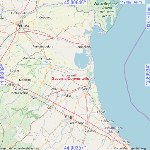
Savarna-Conventello GPS coordinates[2]
44° 30' 25.812" North, 12° 6' 22.356" East
| Map corner | latitude | longitude |
|---|---|---|
| Upper-left | 45.00646°, | 11.40309° |
| Center: | 44.50717°, | 12.10621° |
| Lower-right: | 44.00357°, | 12.80934° |
| Map W x H: | 111.5×111.5 km | = 69.3×69.3mi |
| max Lat: | 47.04031° ⇑48.9% North |
| Savarna-Conventello: | 44.50717° |
| min Lat: | ⇓51.1% South 35.50142° |
| min Long | Savarna-Convent | max Long |
| 6.69888° | 12.10621° | 18.48682° |
| W 57.4%⇐ | ⇒42.6% E |
Elevation
Elevation of Savarna-Conventello is 1 m = 3 ft, and this is 305.7 m = 1003 ft below average elevation for this country.
| Max E: |
2085 m = 6841 ft | 99.4% |
| Avg. | 306.7 m = 1006 ft | |
| Savarna-Conventello | 1 m = 3 ft | |
Min E: |
-4 m = -13 ft | 0.6% |
See also: Italy elevation on elevation.city.
Geographical zone
Savarna-Conventello is located in North temperate zone (between Tropic of Cancer and the Arctic Circle). Distance of this Northern Tropic circle is 2342.8 km =1455.7 mi to South.| Distance of | km | miles | from Savarna-Conventello |
|---|---|---|---|
| North Pole | 5058.3 | 3143.1 | to North |
| Arctic Circle | 2452.4 | 1523.9 | to North |
| Tropic Cancer | 2342.8 | 1455.7 | to South |
| Equator | 4948.7 | 3075 | to South |


Nearby cities:
15 places around Savarna-Conventello: (largest is in red/bold)
• Alfonsine
5.5 km =3.4 mi,  270°
270°
• Alfonsine
6 km =3.7 mi,  200°
200°
• Camerlona
6.8 km =4.2 mi,  168°
168°
• Fornace Zarattini
10.3 km =6.4 mi, 167°
• Fusignano
12.7 km =7.9 mi,  249°
249°
• Glorie
4.7 km =2.9 mi,  209°
209°
• Longastrino
11.8 km =7.3 mi,  319°
319°
• Masiera
12.2 km =7.6 mi, 245°
• Mezzano
4.8 km =3 mi, 199°
• Piangipane
9.6 km =6 mi,  187°
187°
• Ravenna
12.9 km =8 mi,  144°
144°
• San Michele
11.4 km =7.1 mi,  177°
177°
• Sant'Alberto
5.6 km =3.5 mi,  51°
51°
• Santerno
8.8 km =5.5 mi, 207°
• Villanova
7.9 km =4.9 mi, 214°
Sources, notices
• [Note1] Compared only with cities in Italy existing in our database
• [Src1] Map data: © OpenStreetMap contributors (CC-BY-SA)
• [Src2] Other city data from geonames.org with taken over terms of usage.
• [Src3] Geographical zone / Annual Mean Temperature by Robert A. Rohde @ Wikipedia
