Sciarborasca geodata
Sciarborasca (Liguria) is a populated place; located in Italy in Europe/Rome (GMT+2) time zone. With population of 1,732 people, there are 4605 cities with bigger population in this country. Compared to other cities in Italy, 50.4% of cities are located further ↑North; 86.5% of cities are located further →East and 55.6% of cities have higher elevation than Sciarborasca. Note1


Sciarborasca GPS coordinates[2]
44° 24' 6.552" North, 8° 36' 55.476" East
| Map corner | latitude | longitude |
|---|---|---|
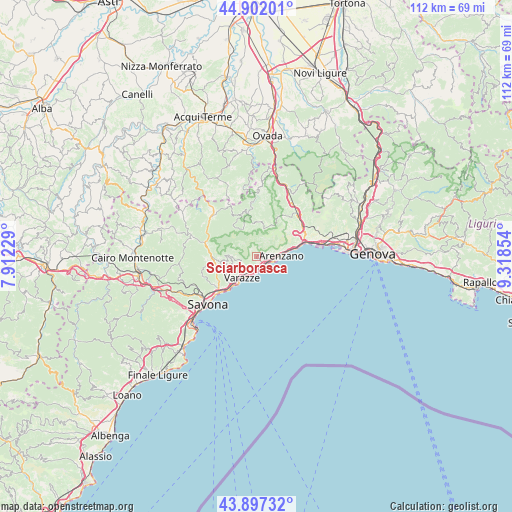
| Upper-left | 44.90201°, | 7.91229° |
| Center: | 44.40182°, | 8.61541° |
| Lower-right: | 43.89732°, | 9.31854° |
| Map W x H: | 111.7×111.7 km | = 69.4×69.4mi |
| max Lat: | 47.04031° ⇑50.4% North |
| Sciarborasca: | 44.40182° |
| min Lat: | ⇓49.6% South 35.50142° |
| min Long | Sciarborasca | max Long |
| 6.69888° | 8.61541° | 18.48682° |
| W 13.5%⇐ | ⇒86.5% E |
Elevation
Elevation of Sciarborasca is 198 m = 650 ft, and this is 108.7 m = 357 ft below average elevation for this country.
| Max E: |
2085 m = 6841 ft | 55.6% |
| Avg. | 306.7 m = 1006 ft | |
| Sciarborasca | 198 m = 650 ft | |
Min E: |
-4 m = -13 ft | 44.4% |
See also: Italy elevation on elevation.city.
Geographical zone
Sciarborasca is located in North temperate zone (between Tropic of Cancer and the Arctic Circle). Distance of this Northern Tropic circle is 2331.1 km =1448.5 mi to South.| Distance of | km | miles | from Sciarborasca |
|---|---|---|---|
| North Pole | 5070 | 3150.4 | to North |
| Arctic Circle | 2464.2 | 1531.2 | to North |
| Tropic Cancer | 2331.1 | 1448.5 | to South |
| Equator | 4937 | 3067.7 | to South |


Nearby cities:
15 places around Sciarborasca: (largest is in red/bold)
• Albisola Marina
11.5 km =7.1 mi,  226°
226°
• Albisola Superiore
10.9 km =6.8 mi, 230°
• Arenzano
5.4 km =3.4 mi,  85°
85°
• Celle Ligure
8.3 km =5.2 mi,  220°
220°
• Cogoleto
2.8 km =1.7 mi,  117°
117°
• Ellera
12.6 km =7.8 mi,  250°
250°
• Lerca
2.8 km =1.7 mi,  84°
84°
• Mele
11.7 km =7.3 mi,  65°
65°
• Osteria dei Cacciatori-Stella
11.9 km =7.4 mi,  285°
285°
• Pero
5.5 km =3.4 mi, 253°
• San Giovanni
9.4 km =5.8 mi,  264°
264°
• San Martino
8 km =5 mi, 261°
• San Pietro d'Olba
9.8 km =6.1 mi,  347°
347°
• Urbe
9.8 km =6.1 mi, 346°
• Varazze
4.5 km =2.8 mi,  199°
199°
Sources, notices
• [Note1] Compared only with cities in Italy existing in our database
• [Src1] Map data: © OpenStreetMap contributors (CC-BY-SA)
• [Src2] Other city data from geonames.org with taken over terms of usage.
• [Src3] Geographical zone / Annual Mean Temperature by Robert A. Rohde @ Wikipedia
