Foen geodata
Foen (Veneto) is a populated place; located in Italy in Europe/Rome (GMT+2) time zone. With population of 881 people, there are 7265 cities with bigger population in this country. Compared to other cities in Italy, 92.8% of cities are located further ↓South; 54.7% of cities are located further ←West and 61.9% of cities have lower elevation than Foen. Note1


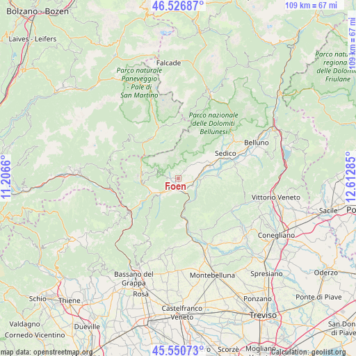
Foen GPS coordinates[2]
46° 2' 27.456" North, 11° 54' 34.992" East
| Map corner | latitude | longitude |
|---|---|---|
| Upper-left | 46.52687°, | 11.2066° |
| Center: | 46.04096°, | 11.90972° |
| Lower-right: | 45.55073°, | 12.61285° |
| Map W x H: | 108.5×108.5 km | = 67.4×67.4mi |
| max Lat: | 47.04031° ⇑7.2% North |
| Foen: | 46.04096° |
| min Lat: | ⇓92.8% South 35.50142° |
| min Long | Foen | max Long |
| 6.69888° | 11.90972° | 18.48682° |
| W 54.7%⇐ | ⇒45.3% E |
Elevation
Elevation of Foen is 314 m = 1030 ft, and this is 7.3 m = 24 ft above average elevation for this country.
| Max E: |
2085 m = 6841 ft | 38.1% |
| Foen | 314 m 1030 ft | |
| Avg. | 306.7 m = 1006 ft | |
Min E: |
-4 m = -13 ft | 61.9% |
See also: Italy elevation on elevation.city.
Geographical zone
Foen is located in North temperate zone (between Tropic of Cancer and the Arctic Circle). Distance of this North polar circle is 2281.9 km =1417.9 mi to North.| Distance of | km | miles | from Foen |
|---|---|---|---|
| North Pole | 4887.8 | 3037.1 | to North |
| Arctic Circle | 2281.9 | 1417.9 | to North |
| Tropic Cancer | 2513.4 | 1561.8 | to South |
| Equator | 5119.3 | 3181 | to South |


Nearby cities:
15 places around Foen: (largest is in red/bold)
• Anzù
4 km =2.5 mi,  153°
153°
• Arten
7.3 km =4.5 mi,  239°
239°
• Cesiomaggiore
7.7 km =4.8 mi,  48°
48°
• Facen-Travagola
3.8 km =2.4 mi,  250°
250°
• Feltre
2.4 km =1.5 mi,  197°
197°
• Fonzaso
9 km =5.6 mi, 252°
• Lentiai
8.6 km =5.3 mi,  86°
86°
• Pedavena
2.1 km =1.3 mi,  265°
265°
• San Gregorio nelle Alpi
11.4 km =7.1 mi, 52°
• Santa Giustina
10.9 km =6.8 mi,  65°
65°
• Seren del Grappa
6.5 km =4 mi,  219°
219°
• Servo
9.7 km =6 mi,  281°
281°
• Sovramonte
9.7 km =6 mi, 281°
• Villabruna-Umin
2.2 km =1.4 mi,  37°
37°
• Villapiana-Ronchena
7 km =4.3 mi,  96°
96°
Sources, notices
• [Note1] Compared only with cities in Italy existing in our database
• [Src1] Map data: © OpenStreetMap contributors (CC-BY-SA)
• [Src2] Other city data from geonames.org with taken over terms of usage.
• [Src3] Geographical zone / Annual Mean Temperature by Robert A. Rohde @ Wikipedia
