Sant'Anna I geodata
Sant'Anna I (Campania) is a populated place; located in Italy in Europe/Rome (GMT+2) time zone. With population of 581 people, there are 9167 cities with bigger population in this country. Compared to other cities in Italy, 82.1% of cities are located further ↑North; 84.6% of cities are located further ←West and 57.9% of cities have lower elevation than Sant'Anna I. Note1
Administrative division(s):
- Level 1: Campania
- Level 2: Provincia di Salerno
- Level 3: Cava de' Tirreni


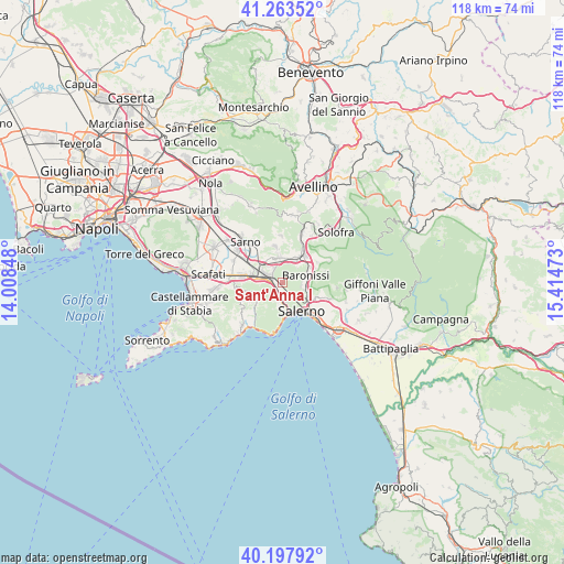
Sant'Anna I GPS coordinates[2]
40° 43' 58.26" North, 14° 42' 41.76" East
| Map corner | latitude | longitude |
|---|---|---|
| Upper-left | 41.26352°, | 14.00848° |
| Center: | 40.73285°, | 14.7116° |
| Lower-right: | 40.19792°, | 15.41473° |
| Map W x H: | 118.5×118.5 km | = 73.6×73.6mi |
| max Lat: | 47.04031° ⇑82.1% North |
| Sant'Anna I: | 40.73285° |
| min Lat: | ⇓17.9% South 35.50142° |
| min Long | Sant'Anna I | max Long |
| 6.69888° | 14.7116° | 18.48682° |
| W 84.6%⇐ | ⇒15.4% E |
Elevation
Elevation of Sant'Anna I is 285 m = 935 ft, and this is 21.7 m = 71 ft below average elevation for this country.
| Max E: |
2085 m = 6841 ft | 42.1% |
| Avg. | 306.7 m = 1006 ft | |
| Sant'Anna I | 285 m = 935 ft | |
Min E: |
-4 m = -13 ft | 57.9% |
See also: Italy elevation on elevation.city.
Geographical zone
Sant'Anna I is located in North temperate zone (between Tropic of Cancer and the Arctic Circle). Distance of this Northern Tropic circle is 1923.1 km =1195 mi to South.| Distance of | km | miles | from Sant'Anna I |
|---|---|---|---|
| North Pole | 5478 | 3403.9 | to North |
| Arctic Circle | 2872.1 | 1784.6 | to North |
| Tropic Cancer | 1923.1 | 1195 | to South |
| Equator | 4529.1 | 2814.3 | to South |


Nearby cities:
15 places around Sant'Anna I: (largest is in red/bold)
• Acquarola
4.2 km =2.6 mi,  16°
16°
• Antessano
5.5 km =3.4 mi,  89°
89°
• Baronissi
5.5 km =3.4 mi,  71°
71°
• Capezzano-Cologna
5.6 km =3.5 mi,  110°
110°
• Capriglia
4.1 km =2.5 mi, 91°
• Casali-San Potito
4.6 km =2.9 mi,  318°
318°
• Castel San Giorgio
5.5 km =3.4 mi,  350°
350°
• Cava Dè Tirreni
3.7 km =2.3 mi,  185°
185°
• Coperchia
4.8 km =3 mi, 107°
• Lanzara
5.5 km =3.4 mi,  327°
327°
• Nocera Superiore
3.3 km =2.1 mi,  288°
288°
• Pellezzano
4 km =2.5 mi,  102°
102°
• Piazza del Galdo-Sant'Angelo
4.6 km =2.9 mi,  5°
5°
• Roccapiemonte
3.5 km =2.2 mi, 330°
• Spiano
4.5 km =2.8 mi,  45°
45°
Sources, notices
• [Note1] Compared only with cities in Italy existing in our database
• [Src1] Map data: © OpenStreetMap contributors (CC-BY-SA)
• [Src2] Other city data from geonames.org with taken over terms of usage.
• [Src3] Geographical zone / Annual Mean Temperature by Robert A. Rohde @ Wikipedia
